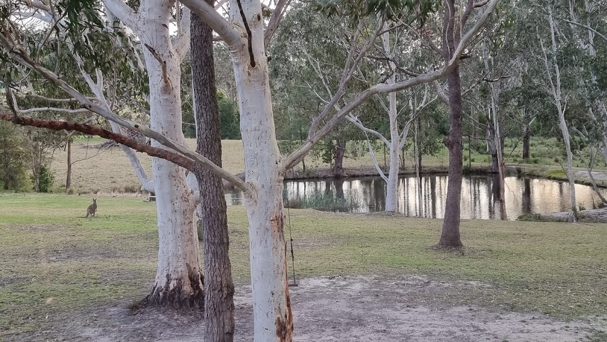
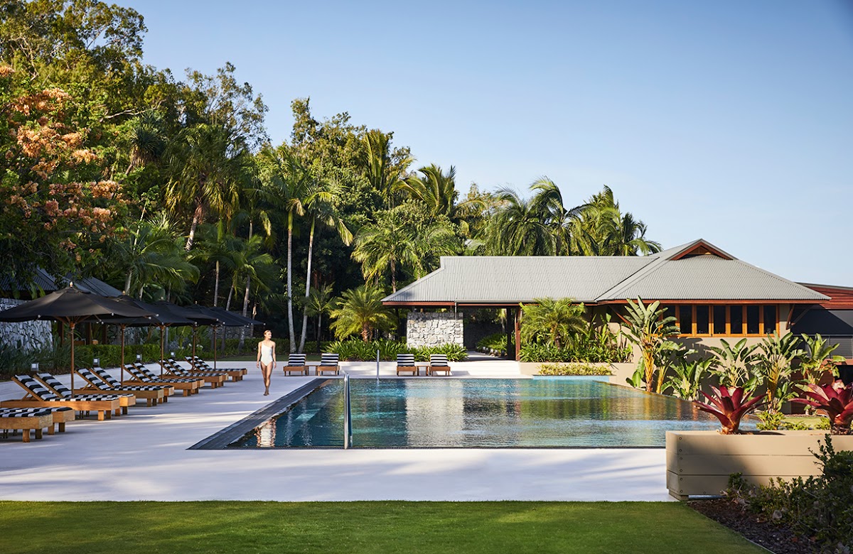
01. The Kimberley Grande Resort
4 (399 reviews)
The Kimberley Grande Resort — The Kimberley
Book Direct & Save →The Kimberley doesn't do convenient. Its best experiences are spread across an area bigger than many countries, most of them down hours of gravel or reached only by light aircraft or boat, and all of them locked to a Dry-season window that runs roughly May to October. So the real question isn't what there is to do here — it's which experiences earn the distance, and how to fit them into a trip that already involves a lot of driving.
View 3 Properties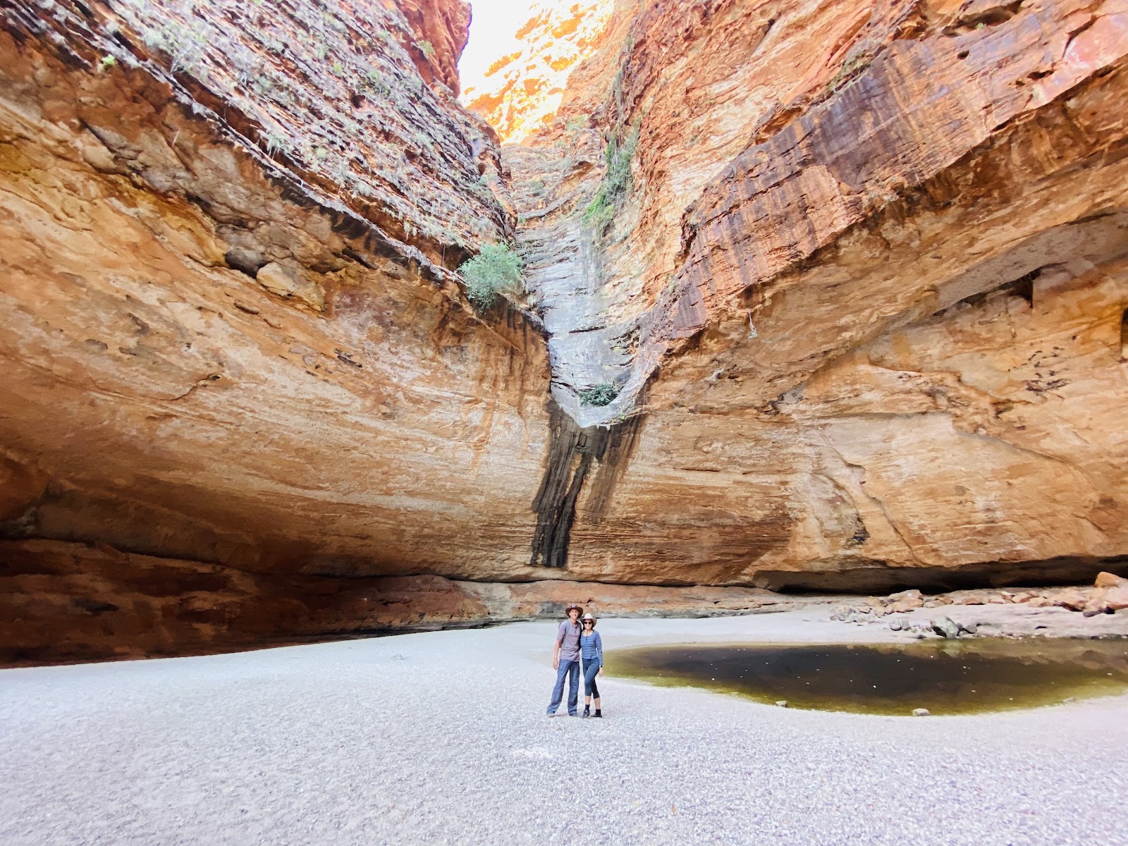
"Iconic wilderness, earned by distance"
This guide ranks the experiences that consistently justify the effort, with the practical detail you need to slot each into a plan — what it actually involves, how you reach it, who it suits, and the honest catch. Some are headline icons you'll have seen in photographs; a couple are quieter and reward the travellers willing to go further. A note that runs through all of them: this is remote country with real hazards. Carry more fuel and water than you think you need, check road and park status before each leg, and never swim anywhere the signage and local advice don't confirm is safe from crocodiles.
The mistake first-timers make is treating the Kimberley like a single destination with a list of nearby attractions. It isn't. The Bungle Bungles and Lake Argyle anchor the east around Kununurra; the gorges string along the Gibb River Road through the middle; Horizontal Falls, Cape Leveque and the wild coast belong to the west around Broome and Derby. You can't do all of it in one short trip, and the travellers who try end up spending their holiday behind a windscreen.
So the list below isn't a checklist to complete — it's a menu to choose from based on your time, your vehicle and how much driving you're willing to do. Pick an end to fly into, decide whether you're self-driving the gravel or seeing the icons by scenic flight and cruise, and build around three or four experiences you'll do properly rather than ten you'll rush. The ranking that follows reflects which experiences most reliably reward the effort — start at the top and work down to whatever your trip has room for.
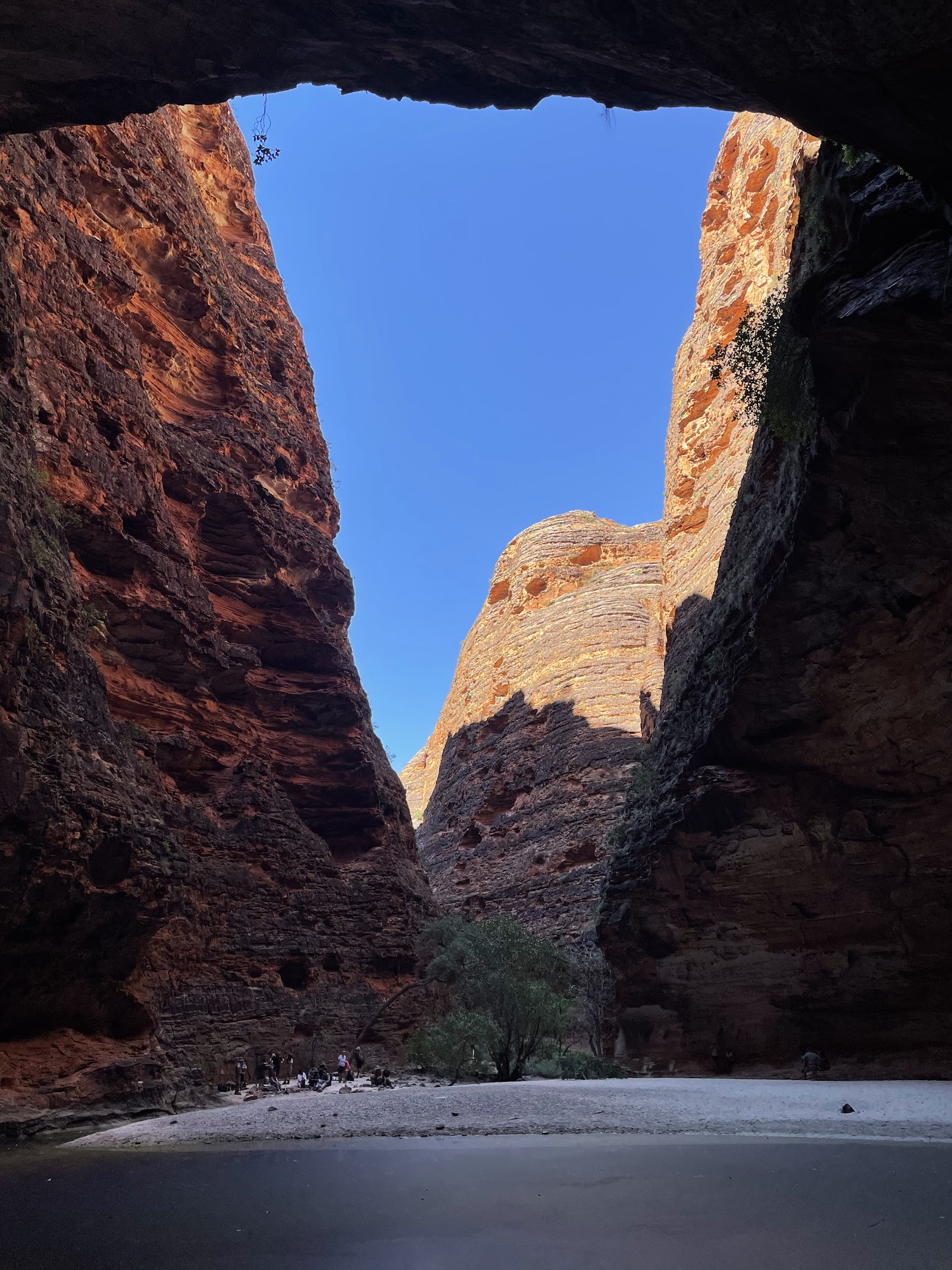
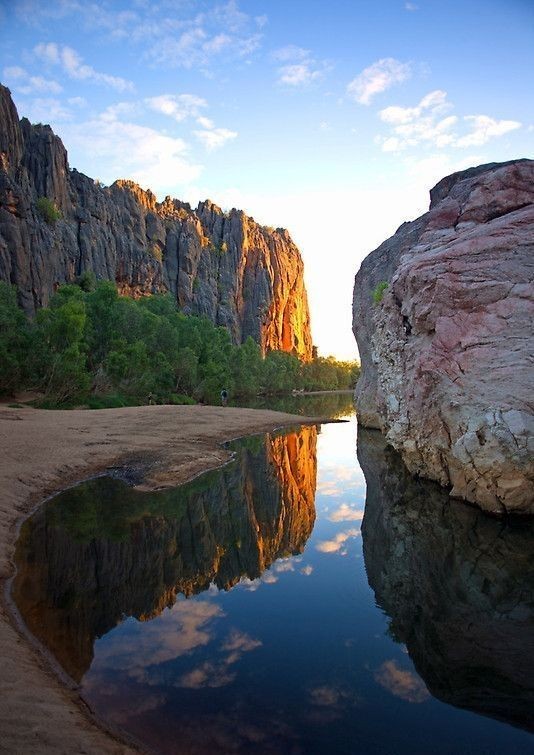
If you do one thing in the Kimberley, make it the Bungle Bungles. The orange-and-grey banded sandstone domes of the Bungle Bungle Range, in World Heritage-listed Purnululu National Park, are unlike anything else on Earth — one of the world's finest examples of cone karst, 360-million-year-old sandstone weathered into beehive towers. The southern trails walk you in among the domes to Cathedral Gorge, a vast natural amphitheatre of red rock where a single voice carries; the northern end holds Echidna Chasm, a sliver of a gorge barely a metre wide in places with walls up to 200 metres high, lined with Livistona palms.
The catch is access, and it's a real one. Purnululu sits about 300 kilometres south of Kununurra, and the final 53-kilometre Spring Creek Track in from the highway is a slow, rough, creek-crossing 4WD route that takes one and a half to three hours and is off-limits to most hire and 2WD vehicles. If you don't have a high-clearance 4WD, the scenic flight from Kununurra or Halls Creek is the answer — and for the dome field itself, that aerial view is arguably the best perspective there is. Whichever way you come, stay overnight if you can: the domes at first and last light are the photograph everyone wants.
Nothing else in Australia looks like the striped domes, and standing in Cathedral Gorge's red amphitheatre is the moment most travellers say defined their whole Kimberley trip.
“Walked into Cathedral Gorge and just stopped talking — the scale and the acoustics are unreal. The flight in over the domes the next morning was the best money we spent on the whole trip.”
— Traveller review
Cathedral Gorge’s amphitheatre on foot, and the striped domes from a dawn or dusk scenic flight.
Don't attempt the Spring Creek Track in a 2WD or most hire cars — it's high-clearance 4WD only and takes hours. If you can't drive it, fly; and avoid the Wet season entirely, when the park is closed.
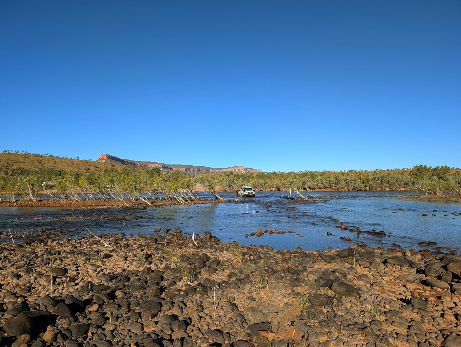
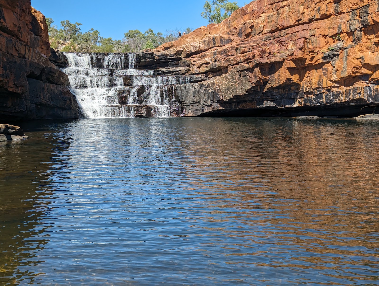
The Gibb River Road is the Kimberley road trip — 660 kilometres of gravel between Derby and the Kununurra–Wyndham junction, built as a cattle route and still rough enough to feel like one. Corrugations, bull dust, river crossings and long empty stretches are the price of admission; a high-clearance four-wheel drive with two spare tyres is the minimum kit, and a good number of travellers rate the drive itself as memorable as the stops. This is the route that connects the great inland gorges — Windjana and Tunnel Creek at the western end, Bell, Galvans, Adcock and Manning through the middle, and the turn north to the Mitchell Plateau.
Don't rush it. The Gibb rewards seven to fourteen days, not a two-day transit — the gorges and the swims are the experience, and the driving between them is slow. Fuel is available at a handful of stations and stations-turned-stays along the way (Imintji, Mount Barnett, Drysdale River), but you plan around them rather than assume them, and you carry recovery gear and the skills to use it. Check the road is open before you start, especially early and late in the Dry, and treat it as the genuine remote-touring undertaking it is rather than a scenic drive.
It's the drive that turns the Kimberley from a place you visit into a journey you remember — every gorge swim earned by the dusty kilometres between them.
“The Gibb is the trip. Dust, river crossings, a flat tyre, and then a swim under a waterfall with no one else there. Hardest and best drive we have ever done.”
— Traveller review
Stringing the gorge swims together over a week or more — Windjana and Tunnel Creek to Bell and Manning.
Not a soft-road drive — corrugations and crossings will punish the wrong vehicle. Don't attempt it without a high-clearance 4WD, two spares, recovery gear and the skills to change a tyre. Check it's open first.
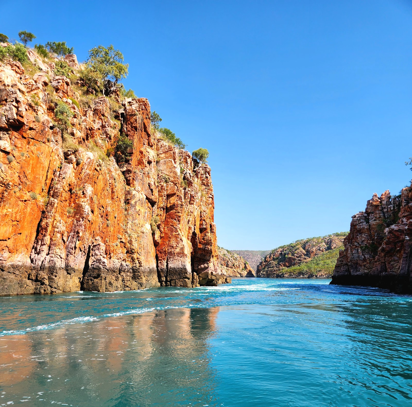
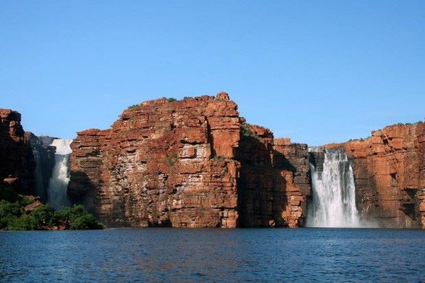
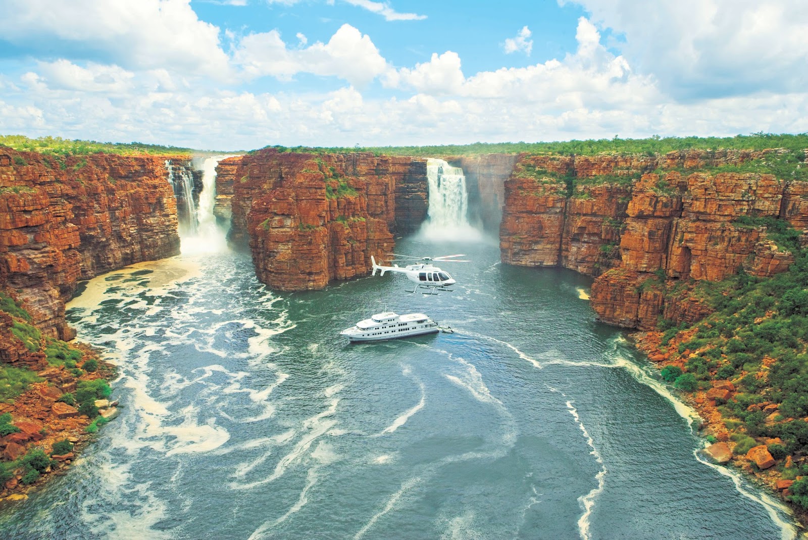
Horizontal Falls isn't a waterfall at all — it's a tidal phenomenon, where enormous Kimberley tides force seawater through two narrow gaps in the McLarty Range fast enough to create a churning, sideways 'waterfall' that reverses with the tide. David Attenborough called it one of the great natural wonders of the world, and seen from a seaplane banking over Talbot Bay and the maze of the Buccaneer Archipelago, it earns the billing. Most visitors reach it on a day trip by seaplane from Broome or Derby, often combined with a boat cruise of the bay.
There's an important change to know about. At the request of the Dambeemangaddee Traditional Owners, for whom this is a sacred place tied to the creator serpent Woongudd, tour boats are being phased out of running through the gaps — most operators by the end of 2026 and the main seaplane operator by 2028. Boats will still cruise Talbot Bay for a close view, and the scenic flight over the falls and the archipelago is spectacular regardless. Check the current arrangements when you book, and treat the cultural significance of the place with the respect the change reflects.
Seeing the tide pour sideways through the cliffs from a low-banking seaplane is the most jaw-dropping few minutes of aerial scenery in the Kimberley.
“The seaplane flight over the falls and all those red islands was unforgettable — water rushing sideways through a gap in the cliffs like nothing I have seen. Worth every cent.”
— Google review
The seaplane flight over Talbot Bay and the Buccaneer Archipelago, with the falls churning below.
Boat trips through the gaps are being phased out (most operators by end of 2026) at the Traditional Owners' request — don't bank a trip on running the falls. It's a premium-priced day, and seaplanes are weather-dependent.
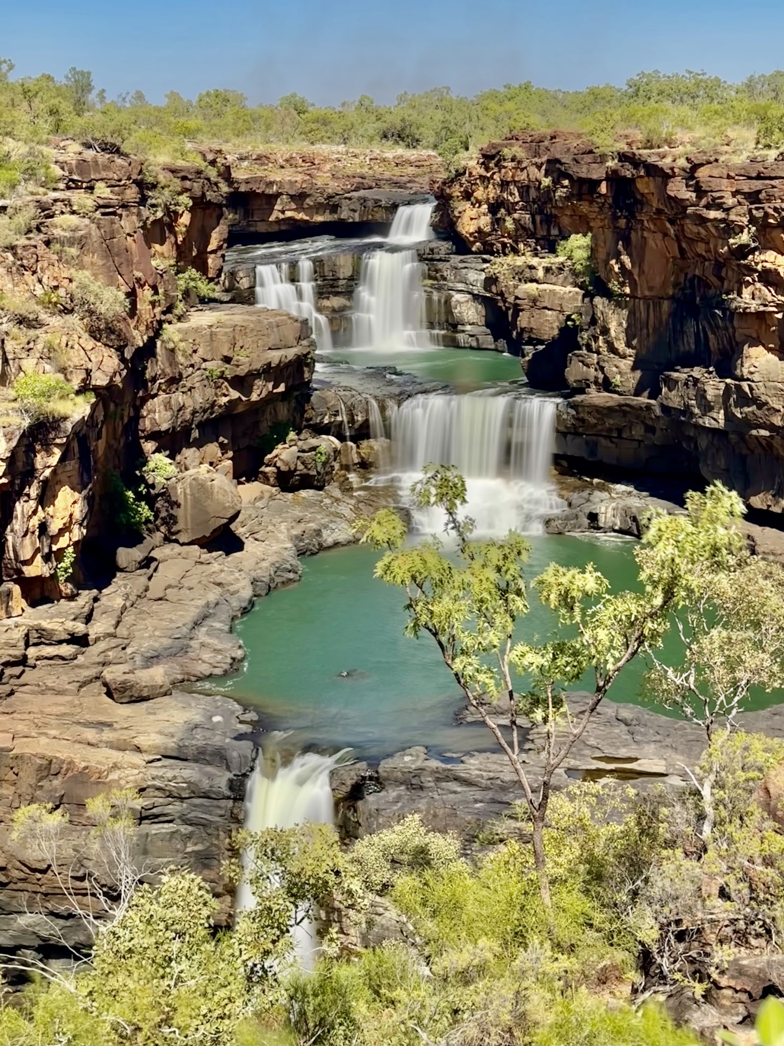
Mitchell Falls — Punamii-Uunpuu to the Wunambal people, for whom it is a place of deep cultural and spiritual significance — is the most photographed waterfall in the Kimberley and one of the hardest to reach. The Mitchell River drops over four tiers into a chain of emerald pools, and the classic view comes at the end of an 8.6-kilometre return walk that takes four to six hours, passing rock art, Little Mertens Falls and Mertens Gorge on the way. Many walkers take a helicopter back one way to save their legs and get the aerial view of the tiers.
Getting to the trailhead is the real expedition. The Mitchell Plateau is reached via the Kalumburu Road and the rough Mitchell Plateau track north of the Gibb River Road — corrugated, slow, fuel-and-water-serious 4WD country that's among the most remote driving in the region. Many travellers skip the drive and reach the falls by scenic flight or as a fly-in walk. However you come, treat the site as the sacred place it is — stay on the trail, follow any signage about restricted areas, and don't touch the rock art.
It's the wildest, most remote of the great Kimberley falls — the four emerald tiers feel genuinely hard-won, whether you walk in or fly.
“A hot, long walk past rock art and smaller falls, and then the four tiers open up in front of you. We took the chopper back and saw the whole thing from the air. The most remote place we have ever stood.”
— Traveller review
The four-tiered falls from the lookout, ideally with a one-way helicopter flight for the aerial view.
The drive in is serious, remote 4WD country — don't underestimate fuel, water and distance. The walk is long and hot with little shade; skip it in the late-Dry heat, and respect that this is a sacred site.
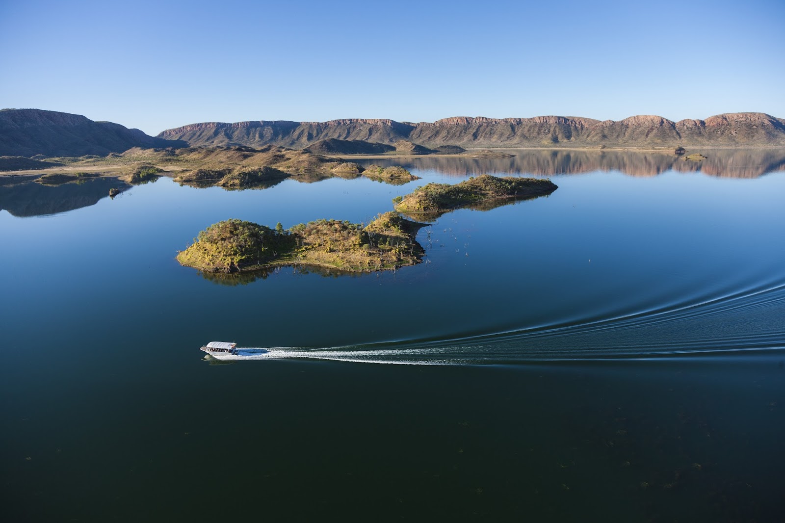
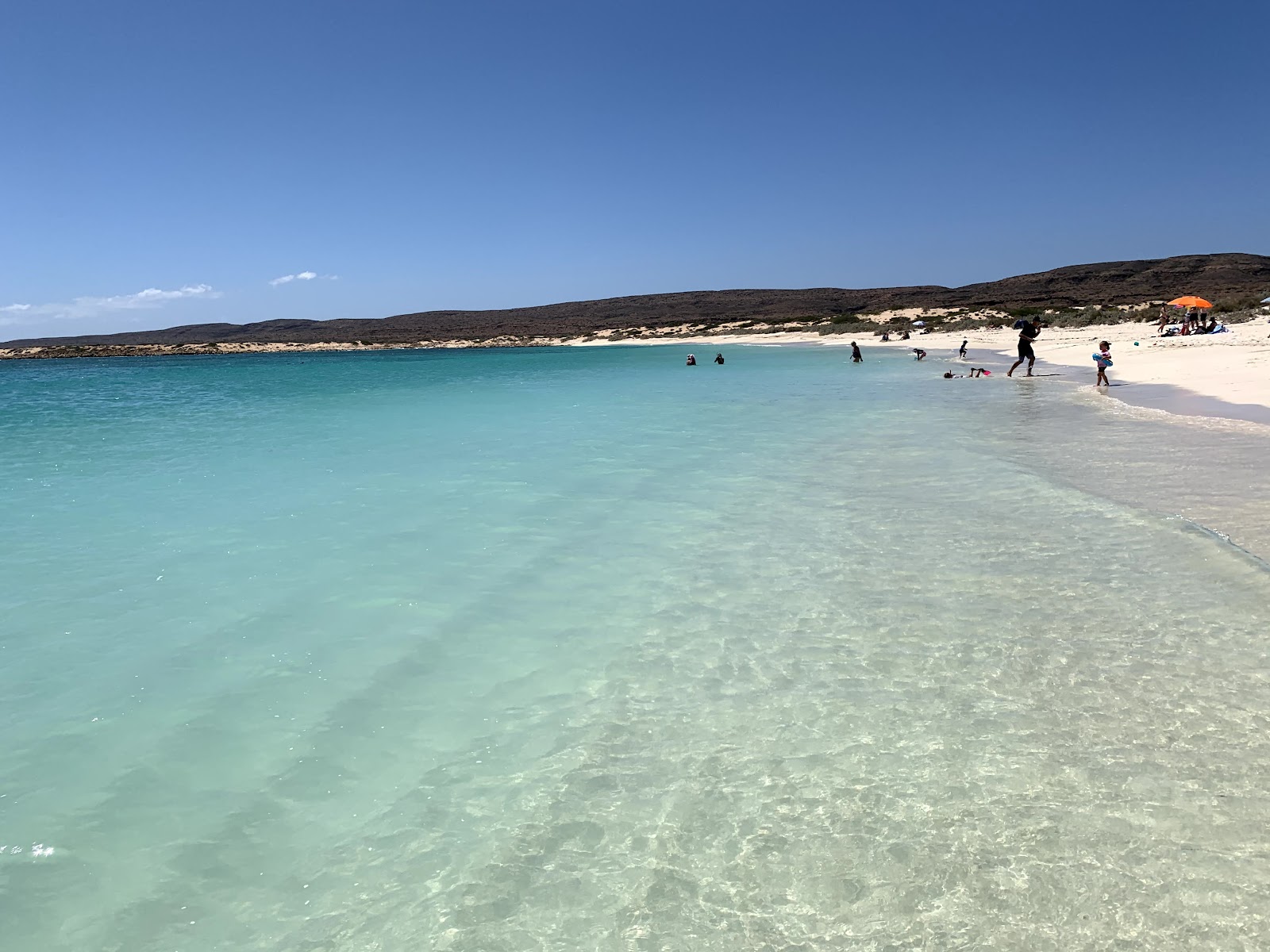
Lake Argyle is the surprise of the east Kimberley — a vast freshwater inland sea created by the damming of the Ord River, dotted with islands, ringed by red ranges, and home to freshwater crocodiles, a huge population of birds and rock wallabies on the islets. A sunset cruise on the lake is one of the most relaxed and accessible highlights in the whole region: you watch the ranges turn red as the sun drops, often with a swim off the boat in the open, croc-safe water of the main lake, well away from the shallows.
The appeal is partly that it's easy. Lake Argyle sits about 70 kilometres south-east of Kununurra on a sealed road, so you don't need a 4WD to reach it — a welcome break from the gravel, and a reason it suits families, less mobile travellers and anyone who wants a big Kimberley moment without an expedition. The cruises run through the Dry; book ahead in peak season, bring sun protection for the open boat, and take the operator's lead on exactly where it's safe to swim, because the rule about crocodiles applies even here.
It's the easiest big-payoff experience in the Kimberley — a sealed-road drive, a sunset over an inland sea, and a swim off the boat with the ranges glowing red.
“The sunset cruise was the most relaxed evening of our trip — a swim off the back of the boat as the sun went down over the islands and ranges. No 4WD needed, the kids loved it.”
— Google review
A sunset cruise with a swim off the boat as the ranges turn red over the water.
Only swim exactly where the crew direct you — the open lake is managed for swimming, the shallows and inlets are not. Book ahead in peak Dry, and bring serious sun cover for the exposed boat.
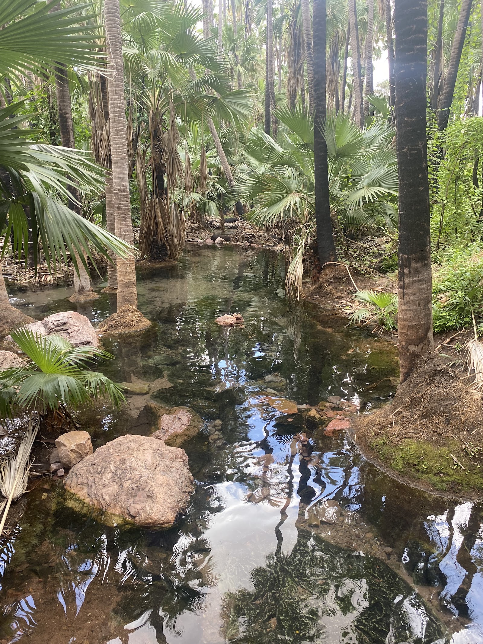
El Questro Wilderness Park, near the eastern end of the Gibb River Road, packs a lot of the Kimberley into one accessible property — and offers a rare range of comfort, from campground to the cliff-top homestead. The standout is Zebedee Springs, a series of warm thermal pools shaded by Livistona palms that feel like a reward after dusty days on the road (it's open mornings only, to protect the site and to give homestead guests afternoon access, so plan around the hours). Emma Gorge nearby ends at a towering rock wall with a deep, cool pool and a thermal trickle down one side.
What makes El Questro work is the spread of options. There are easy walks and harder ones, gorge swims, river cruises on the Chamberlain Gorge, scenic 4WD tracks and sunset lookouts — so a family, a couple and a hard-core hiker can all find their level on the same property. It's busier and more managed than the wild gorges further west, which is exactly the appeal for some travellers and the drawback for others. A park pass is required; check current access, opening hours for the springs, and which tracks are open before you arrive.
It's the one place on the Gibb where every kind of traveller is catered for — a soak in the palm-shaded thermal springs after days of dust is the universal highlight.
“Zebedee Springs in the morning after days on the Gibb was pure bliss — warm water under the palms. Loved that there was something for everyone, from easy walks to proper gorges.”
— Traveller review
A morning soak in the palm-shaded Zebedee thermal springs, then the swim at Emma Gorge.
Zebedee Springs is mornings-only and gets busy — go early. It's more managed and crowded than the wild gorges; if you want solitude, this isn't where you'll find it. A park pass is required.
At the western end of the Gibb River Road, Windjana Gorge (Bandilngan) cuts through the Napier Range — the fossilised remains of a 350-million-year-old Devonian reef, when this dry country was a tropical sea. The walk along the sandy gorge floor passes pools where freshwater crocodiles bask on the banks in numbers, generally undisturbed and watched from a respectful distance; it's one of the most reliable places in the Kimberley to see crocodiles in the wild on foot, in daylight, from solid ground.
A short drive away, Tunnel Creek (Dimalurru) is something else entirely — a 750-metre cave passage carved by the creek straight through the Napier Range, which you wade through in the dark by torchlight, emerging into daylight at the far end. It's flat and walkable but you'll get wet, you need a good torch, and it holds deep significance as a refuge connected to the resistance leader Jandamarra. Both parks are reached via the western Gibb and are doable as a day from Derby; check water levels at Tunnel Creek and never wade if the creek is high.
Watching wild freshwater crocodiles from the gorge floor at Windjana and then wading a torch-lit cave at Tunnel Creek is the Kimberley's best one-two of geology and wildlife.
“Counted a dozen freshies sunning on the banks at Windjana, completely wild. Then waded Tunnel Creek by torchlight in the dark — the kids talked about it for the rest of the trip.”
— Traveller review
Wild freshwater crocodiles along the Windjana gorge floor, then the torch-lit wade through Tunnel Creek.
Don't approach the crocodiles at Windjana — keep your distance and stay on the path. At Tunnel Creek, never enter if the water is high, bring a reliable torch and expect to get wet to the waist.
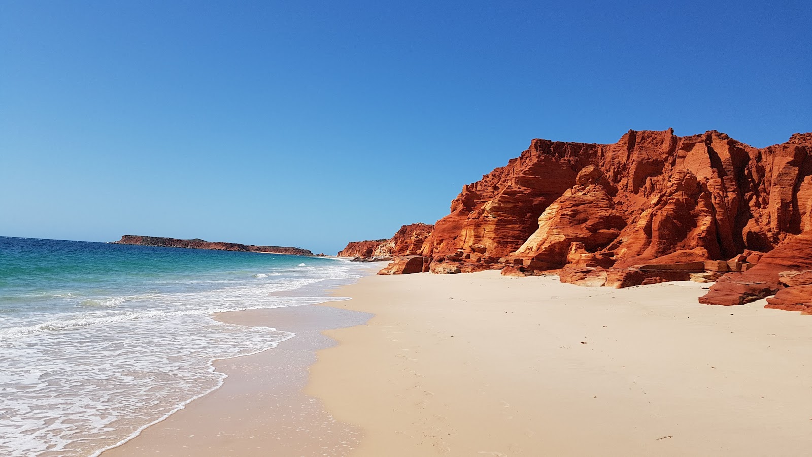
North of Broome, the Dampier Peninsula offers a gentler, more intimate side of the Kimberley — a coastline of vivid red pindan cliffs dropping to white sand and turquoise water, capped at its tip by Cape Leveque (Kooljaman). The drive up the Cape Leveque Road, sealed in recent years, has made this far more accessible than it once was, though side tracks to individual communities and beaches can still be soft sand requiring care. The contrast of red rock, white beach and blue sea here is among the most photographed in the whole region.
What makes the peninsula special is that it's living Bardi Jawi country, and the standout experiences are the cultural ones run by the communities themselves — mud-crabbing and fishing tours, bush-tucker walks, and stays at community-run camps where you learn the saltwater traditions from the people whose Country it is. Many communities welcome visitors but on their terms: some require permits or advance bookings, and access can change. Book community stays and tours ahead, check current access before you drive up, and travel with the respect the place asks for.
It pairs the Kimberley's most striking red-and-white coastline with genuine, community-led cultural experiences you can't get anywhere else.
“The red cliffs against the white beach at Cape Leveque are unreal, but the highlight was a mud-crabbing tour with a Bardi guide — learning the Country from the people who belong to it. Book the community stays ahead.”
— Traveller review
A community-led cultural tour, and the red-cliff-and-white-sand view at Cape Leveque.
Some communities need permits or advance bookings and access changes — don't just turn up. Side tracks off the sealed road can be soft sand; check conditions, and respect that these are people's homes and Country.
The Kimberley holds some of the oldest and most significant rock art on the planet, and seeing it well is one of the most profound things you can do here. Two styles dominate: the ancient Gwion Gwion (Bradshaw) figures — slender, elaborately adorned human forms thought to be among the oldest figurative art known, with likely more than 100,000 paintings across the region — and the later, striking Wandjina, the large mouthless ancestral beings central to the spiritual life of the groups who painted and still care for them.
This is not gallery art behind glass; it's living culture on Country, much of it on restricted land. The right way to see it is on a tour led by Traditional Owners or licensed operators who have the permissions and can explain what you're looking at — which transforms a set of figures on a rock into a story tens of thousands of years deep. Never touch the art, never visit restricted sites without permission, and follow every instruction about photography and access. Several gorge and plateau walks (including the Mitchell Falls trail) pass art sites; treat each as the sacred place it is.
Standing in front of figures painted tens of thousands of years ago, explained by the people whose ancestors made them, is the experience travellers say changed how they saw the whole region.
“Seeing Wandjina and Gwion figures with a Traditional Owner guide put the whole Kimberley in perspective — tens of thousands of years of continuous culture. Do it with a proper cultural tour, not on your own.”
— Traveller review
A Traditional Owner-led tour to a Gwion or Wandjina site, with the story told on Country.
Never touch the art or visit restricted sites without permission. Don't go chasing remote sites unguided — go with a Traditional Owner or licensed cultural operator who has the permissions and the knowledge.
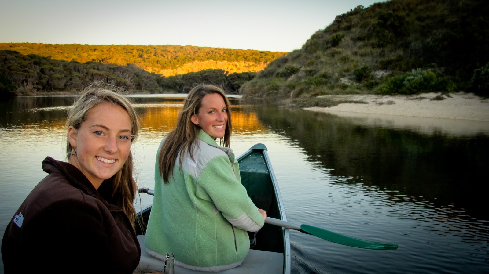
Kununurra is the east Kimberley's most liveable base — a green irrigation town fed by the Ord River scheme, set among boab trees and red cliffs, and the launch point for Lake Argyle, the Bungles flights and the eastern Gibb. The Ord River itself is the quiet highlight here: the stretch between the Lake Argyle dam and Kununurra runs cool, clear and croc-managed enough for popular guided cruises and, for the confident, kayak and canoe trips that drift past sandstone cliffs, abundant birdlife and freshwater crocodiles basking on the banks.
Around town, Mirima National Park (the 'mini Bungles') puts banded sandstone formations and short walks within minutes of the centre, Ivanhoe Crossing offers a classic Kimberley photo (don't drive a flooded causeway), and the Hoochery and local produce trail reflect the surprising agriculture the Ord scheme supports. It's the part of a Kimberley trip where you can do a little less driving and a little more relaxing — a useful counterweight to the gorges and the gravel, and an easy place to base a family for a few days.
It's the green, easygoing heart of the east Kimberley — a cool paddle or cruise on the Ord between red cliffs and boabs, with the big-ticket flights and Lake Argyle on the doorstep.
“Canoed a section of the Ord between the dam and Kununurra — clear water, red cliffs, birds everywhere and freshies on the banks. A lovely change of pace from the gorges. Great base for the Bungles flights too.”
— Google review
A guided cruise or paddle on the Ord between Lake Argyle and Kununurra, with Mirima NP in town.
Only paddle the managed Ord sections and take local advice on crocodiles. Never drive a flooded Ivanhoe Crossing, and don't treat the lower, tidal river as safe water.
The recurring themes across Kimberley traveller reviews and touring accounts:
The happiest travellers picked three or four experiences and did them properly; those who tried to tick everything off spent the trip driving and rated it lower for it.
The Bungles, Horizontal Falls and a gorge swim come up again and again as the experiences that exceeded expectations rather than fell short of the photos.
The single most common frustration is underestimating how far apart and how hard to reach the highlights are — the travellers who researched access and seasons in advance avoided the disappointments.
“OMG...this place reduced me to tears due to being overwhelmed by its grandeur and spectacular scenery. We had two days here but would have loved a week. Echidna Chasm was amazing, Cathedral Gorge breathtaking and Mini Palms gorgeous. I have travelled extensively throughout Europe, Australia, Asia and parts of Canada and the US and l rate this as No 1. This I”— Megan Hollick (on The Bungle Bungles), Google review
“I'll admit that before I visited The Kimberley all I knew about The Bungles Bungles was the classic aerial image of the striated doom rocks. We visited at sunrise so caught the early morning, 'golden hour' light on the ranges. Early start meant that the day use area was not busy, and the trails were cool, shaded and not crowded. Trial heads had maps, paths w”— Zeglar “Zeg” Fergus (on The Bungle Bungles), Google review
“A place that is kinda impossible to review, you gotta see it for yourself! First warning, the track in is not for the faint hearted (even when graded) but if you can do that you will be fine. Its over 45kms from the front gate to the Visitors centre, which you have to stop at and check in if you are staying at either campsite (Walardi or Kurrajon). Special ”— cktravels (on The Bungle Bungles), Google review
| If you want… | Do this | Why |
|---|---|---|
| The single iconic sight | Bungle Bungles (Purnululu) | Nothing else looks like the striped domes — fly in if you can’t drive the track |
| A coastal highlight, no long drives | Horizontal Falls by seaplane | A spectacular half-day from Broome without committing to the gravel |
| The classic road trip | The Gibb River Road | The drive that strings the great gorges together — for prepared 4WD travellers |
| An easy big moment | Lake Argyle sunset cruise | Sealed-road access, a swim off the boat and ranges glowing red at dusk |
| Culture and meaning | Rock art / Dampier Peninsula | Living Aboriginal Country, best understood on a Traditional Owner-led tour |
Getting around: The interior is 4WD country and the distances are enormous — the Bungles, the Gibb gorges and Cape Leveque can each be a day's travel from the others. Decide early whether you're self-driving the gravel or seeing the icons by scenic flight and cruise, and base out of Broome (west) and Kununurra (east) accordingly.
Season and bookings: The Dry (May–October) is the season; May–August has the fullest waterfalls and milder heat. Book scenic flights, Lake Argyle and Horizontal Falls tours, and any remote camp well ahead for peak Dry. Check road and national park status before every leg, especially early and late in the season when roads may still be opening or the heat is building.
Safety: Saltwater crocodiles inhabit most waterways — only swim where signage and local advice confirm it's safe, and follow Be Crocwise. Off the highway, carry far more fuel and water than a southern trip, plus two spare tyres, recovery gear and a satellite phone or EPIRB, because mobile coverage exists only near towns.
Culture and respect: This is Aboriginal country. Some sites and roads need permits or are closed seasonally, rock art must never be touched, and the Horizontal Falls boat tours are being phased out at the Traditional Owners' request — check current arrangements, and choose Traditional Owner-led tours where you can.
The best things to do in the Kimberley aren't hard to find — they're hard to reach, and that's the whole character of the place. The striped domes of the Bungles, the tide pouring sideways at Horizontal Falls, a swim under a gorge waterfall on the Gibb, the four emerald tiers of Mitchell Falls, the red cliffs of Cape Leveque, rock art tens of thousands of years old explained on Country — every one of them sits at the end of real effort, and every one of them rewards it.
The travellers who come home raving are the ones who chose a few of these and did them properly, planned around the season and the distances, and let the Kimberley be the slow, vast, demanding place it is rather than fighting it. Pick your end to fly into, sort the 4WD-or-flights question, book the camps and flights first, and build the rest around three or four experiences from the list above. Do that, and this is the most genuinely wild trip Australia has to offer.
Enjoying things to do? Here’s where else in Australia it’s worth the trip — ranked by how loved each destination is, with the one thing not to miss at each.
 Dubbo
Central West, New South Wales
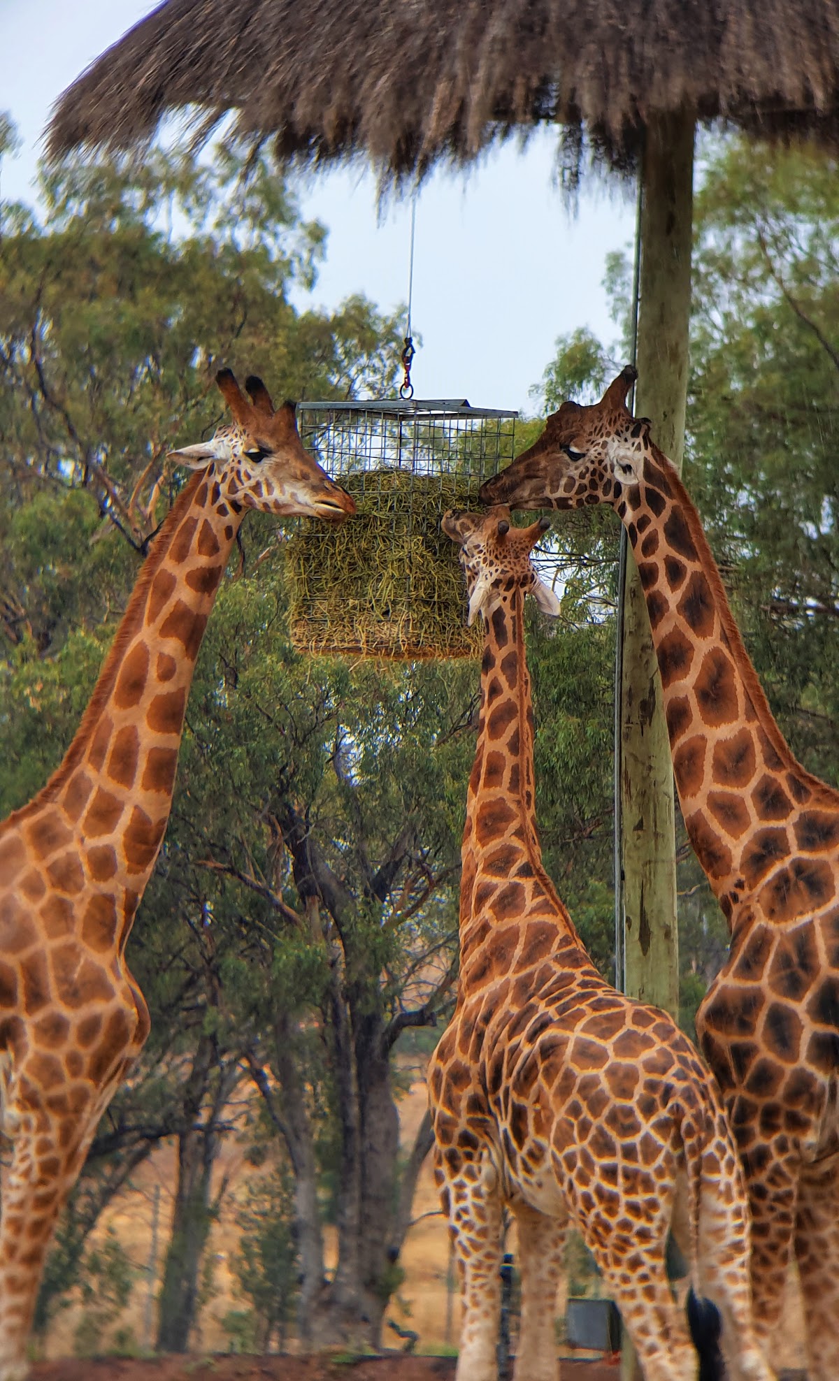
Taronga Western Plains Zoo — Cycling the open-range loop in the cool of early morning, before the heat and the crowds build.
Explore things to do in Dubbo →
2
Dubbo
Central West, New South Wales
Taronga Western Plains Zoo — Cycling the open-range loop in the cool of early morning, before the heat and the crowds build.
Explore things to do in Dubbo →
2
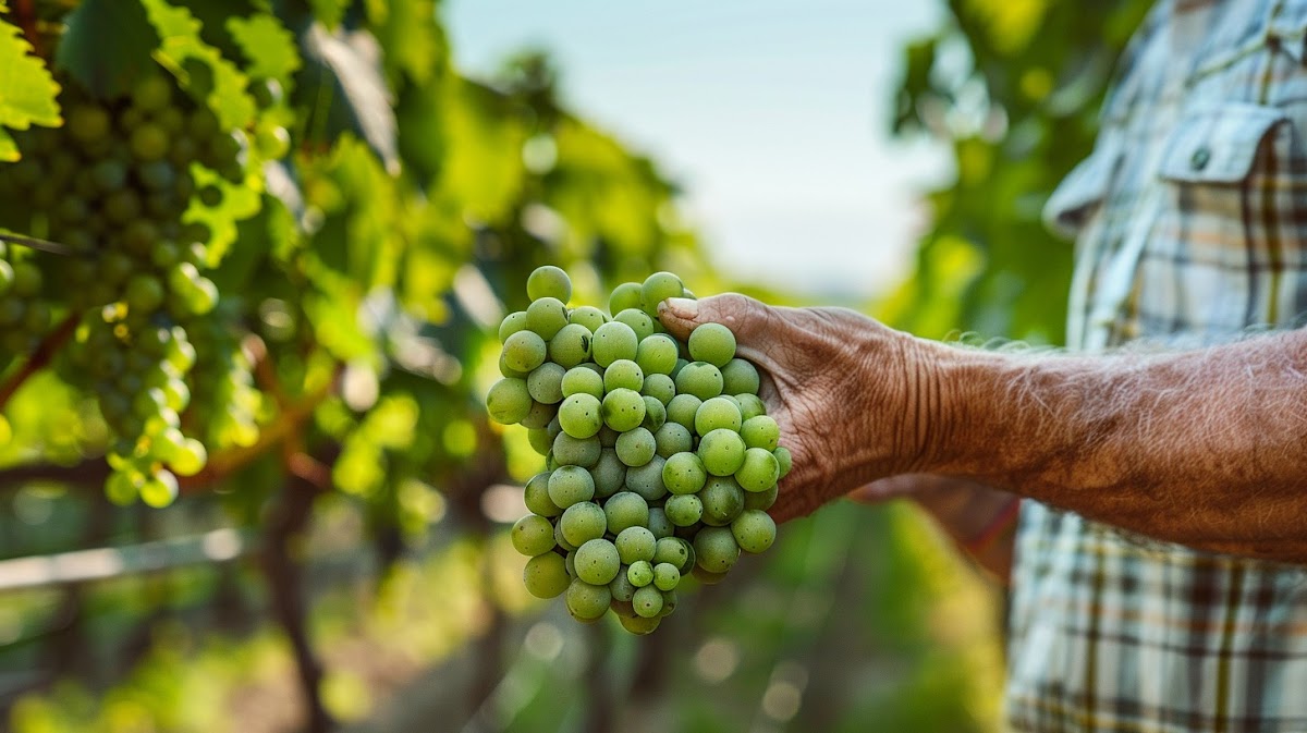
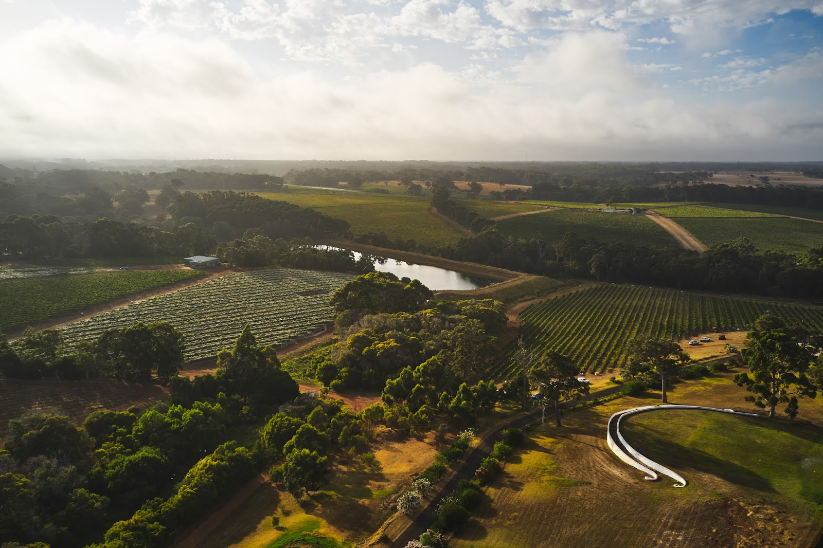
 Margaret River
Australia's South West, Western Australia
Cellar-Door Wine Touring — A long lunch at a cellar-door restaurant, booked ahead, in the middle of a tasting day.
Explore things to do in Margaret River →
3
Margaret River
Australia's South West, Western Australia
Cellar-Door Wine Touring — A long lunch at a cellar-door restaurant, booked ahead, in the middle of a tasting day.
Explore things to do in Margaret River →
3
 Byron Bay
Northern Rivers, New South Wales
Cape Byron lighthouse walk — First light at the easternmost point with humpbacks offshore (May–November).
Explore things to do in Byron Bay →
4
Byron Bay
Northern Rivers, New South Wales
Cape Byron lighthouse walk — First light at the easternmost point with humpbacks offshore (May–November).
Explore things to do in Byron Bay →
4
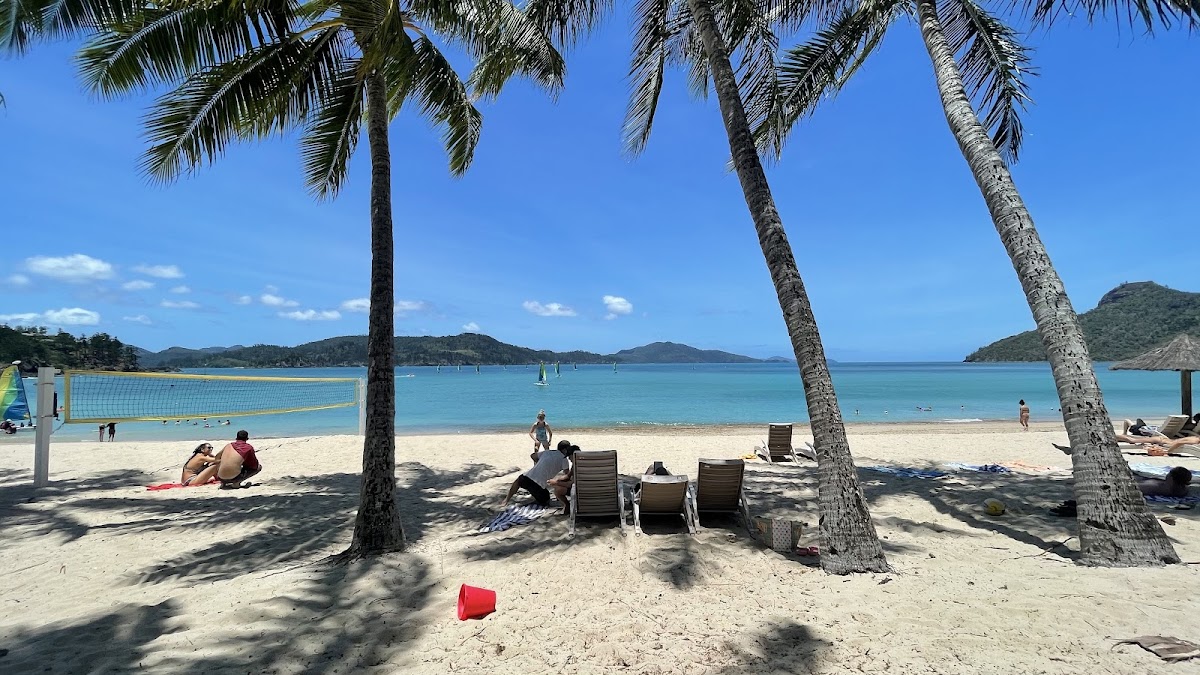 Hamilton Island
The Whitsundays, Queensland
Whitehaven Beach & Hill Inlet day trip — The Hill Inlet lookout from Tongue Point at low-to-mid tide, when the sand and water swirl together.
Explore things to do in Hamilton Island →
5
Hamilton Island
The Whitsundays, Queensland
Whitehaven Beach & Hill Inlet day trip — The Hill Inlet lookout from Tongue Point at low-to-mid tide, when the sand and water swirl together.
Explore things to do in Hamilton Island →
5
 Glen Aplin
Granite Belt, Queensland
Wine tasting at the cellar doors — A winemaker-led tasting at a small cellar door, early while your palate is fresh.
Explore things to do in Glen Aplin →
6
Glen Aplin
Granite Belt, Queensland
Wine tasting at the cellar doors — A winemaker-led tasting at a small cellar door, early while your palate is fresh.
Explore things to do in Glen Aplin →
6
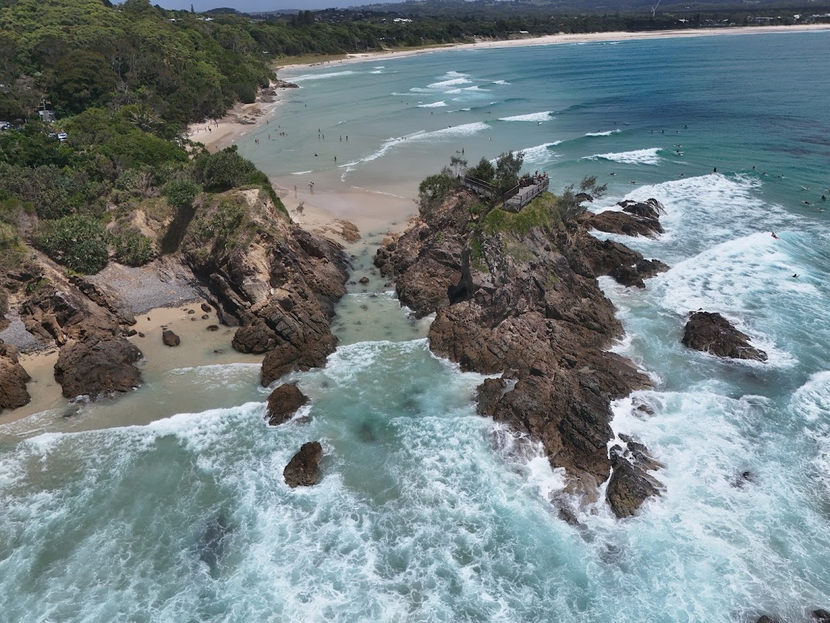
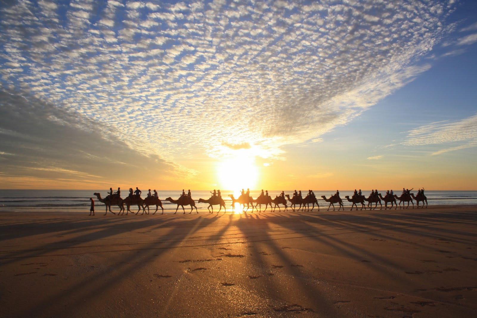
 Broome
Australia's North West, Western Australia
Sunset Camel Ride on Cable Beach — Riding the camel train along the tideline as the sun hits the horizon over the Indian Ocean.
Explore things to do in Broome →
The Kimberley you’re here
Australia's North West, Western Australia
The Bungle Bungles & Cathedral Gorge, Purnululu — Cathedral Gorge’s amphitheatre on foot, and the striped domes from a dawn or dusk scenic flight.
You’re reading this guide
Broome
Australia's North West, Western Australia
Sunset Camel Ride on Cable Beach — Riding the camel train along the tideline as the sun hits the horizon over the Indian Ocean.
Explore things to do in Broome →
The Kimberley you’re here
Australia's North West, Western Australia
The Bungle Bungles & Cathedral Gorge, Purnululu — Cathedral Gorge’s amphitheatre on foot, and the striped domes from a dawn or dusk scenic flight.
You’re reading this guide
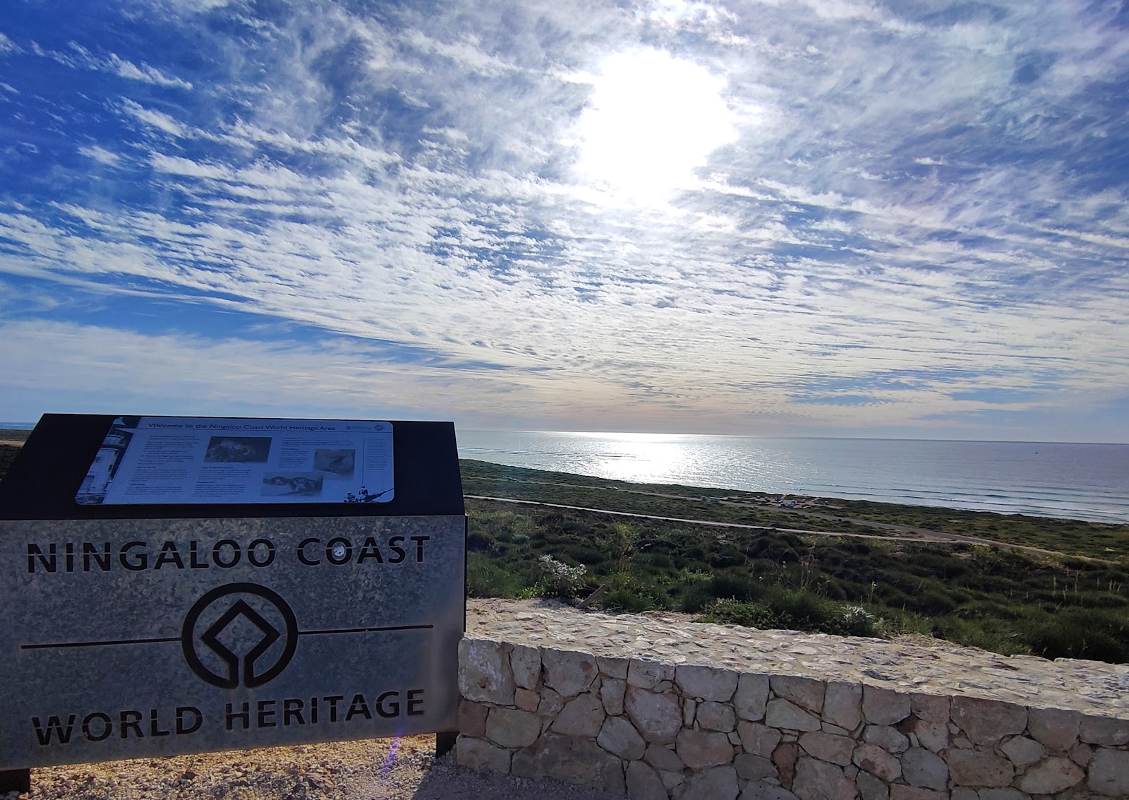 Ningaloo Reef
Australia's Coral Coast, Western Australia
Swim with Whale Sharks — The first time the shark materialises out of the blue beneath you — nothing prepares you for the size.
Explore things to do in Ningaloo Reef →
9
Ningaloo Reef
Australia's Coral Coast, Western Australia
Swim with Whale Sharks — The first time the shark materialises out of the blue beneath you — nothing prepares you for the size.
Explore things to do in Ningaloo Reef →
9
 Kangaroo Valley
Shoalhaven, New South Wales
Paddle the Kangaroo River — The quiet upstream stretch from Hampden Bridge, paddled early before the hire crowd arrives.
Explore things to do in Kangaroo Valley →
10
Kangaroo Valley
Shoalhaven, New South Wales
Paddle the Kangaroo River — The quiet upstream stretch from Hampden Bridge, paddled early before the hire crowd arrives.
Explore things to do in Kangaroo Valley →
10
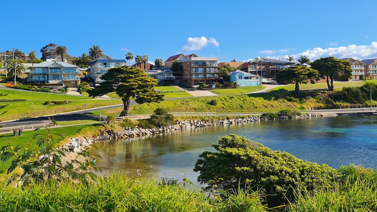 Narooma
South Coast, New South Wales
Sunrise at Narooma Headland — Arriving 20 minutes before sunrise in winter, when the light catches the spray off the headland.
Explore things to do in Narooma →
Narooma
South Coast, New South Wales
Sunrise at Narooma Headland — Arriving 20 minutes before sunrise in winter, when the light catches the spray off the headland.
Explore things to do in Narooma →

The Kimberley Grande Resort — The Kimberley
Book Direct & Save →
Best Western Cambridge Hotel Kununurra — The Kimberley
Book Direct & Save →
Hotel Kununurra — The Kimberley
Book Direct & Save →Skip OTA fees. Connect directly with The Kimberley owners for the best rates and a truly personal experience.
We match any online rate. No service fees — 100% of your payment supports local owners.
Direct guests receive complimentary hampers, early check-in, and priority access to experiences.
Speak directly with the people who manage the properties. No call centres, just local expertise.
Part of Western Australia · Australia's North West
 Glen Aplin
Granite Belt, Queensland
Queensland's most underrated wine valley
Explore the guide →
Glen Aplin
Granite Belt, Queensland
Queensland's most underrated wine valley
Explore the guide →
 Hamilton Island
The Whitsundays, Queensland
Whitsundays island resort — Whitehaven Beach, reef trips and golf-buggy life
Explore the guide →
Hamilton Island
The Whitsundays, Queensland
Whitsundays island resort — Whitehaven Beach, reef trips and golf-buggy life
Explore the guide →
 Narooma
South Coast, New South Wales
Crystal-clear inlet, surf beaches, oysters and Montague Island
Explore the guide →
Narooma
South Coast, New South Wales
Crystal-clear inlet, surf beaches, oysters and Montague Island
Explore the guide →
 Kangaroo Valley
Shoalhaven, New South Wales
Hampden Bridge, kayaking and wombats in a green valley
Explore the guide →
Kangaroo Valley
Shoalhaven, New South Wales
Hampden Bridge, kayaking and wombats in a green valley
Explore the guide →
 Dubbo
Central West, New South Wales
Open-range zoo and Outback gateway on the Macquarie River
Explore the guide →
Dubbo
Central West, New South Wales
Open-range zoo and Outback gateway on the Macquarie River
Explore the guide →
 Byron Bay
Northern Rivers, New South Wales
Australia's iconic beach town and most easterly point
Explore the guide →
Byron Bay
Northern Rivers, New South Wales
Australia's iconic beach town and most easterly point
Explore the guide →
 Ningaloo Reef
Australia's Coral Coast, Western Australia
Swim with whale sharks and snorkel a World-Heritage reef straight off the beach
Explore the guide →
Ningaloo Reef
Australia's Coral Coast, Western Australia
Swim with whale sharks and snorkel a World-Heritage reef straight off the beach
Explore the guide →
 Broome
Australia's North West, Western Australia
Cable Beach sunsets, pearling history and camels on 22km of sand
Explore the guide →
Broome
Australia's North West, Western Australia
Cable Beach sunsets, pearling history and camels on 22km of sand
Explore the guide →
 Margaret River
Australia's South West, Western Australia
World-class wineries, surf breaks and limestone caves three hours south of Perth
Explore the guide →
Margaret River
Australia's South West, Western Australia
World-class wineries, surf breaks and limestone caves three hours south of Perth
Explore the guide →