01. Margarets Beach Resort
4.5 (689 reviews)
Margarets Beach Resort — Margaret River
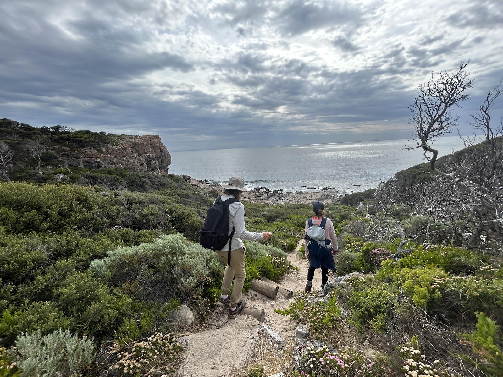
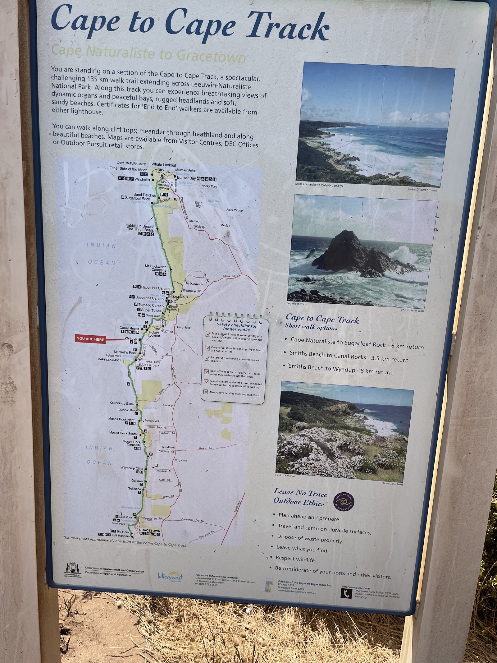
Book Direct & Save →Margaret River sits inside one of the most walkable stretches of the Australian coast. The 135km Cape-to-Cape Track runs from Cape Naturaliste in the north to Cape Leeuwin in the south, linking sea cliffs, limestone headlands, karri-and-peppermint bush corridors and surf beaches into the best multi-day coastal walk in Western Australia. You don't need to walk all of it — the day-walk sections between trailheads are excellent independently, and several of the most memorable experiences in the South West region are a short, easy walk from a car park.
View 3 Properties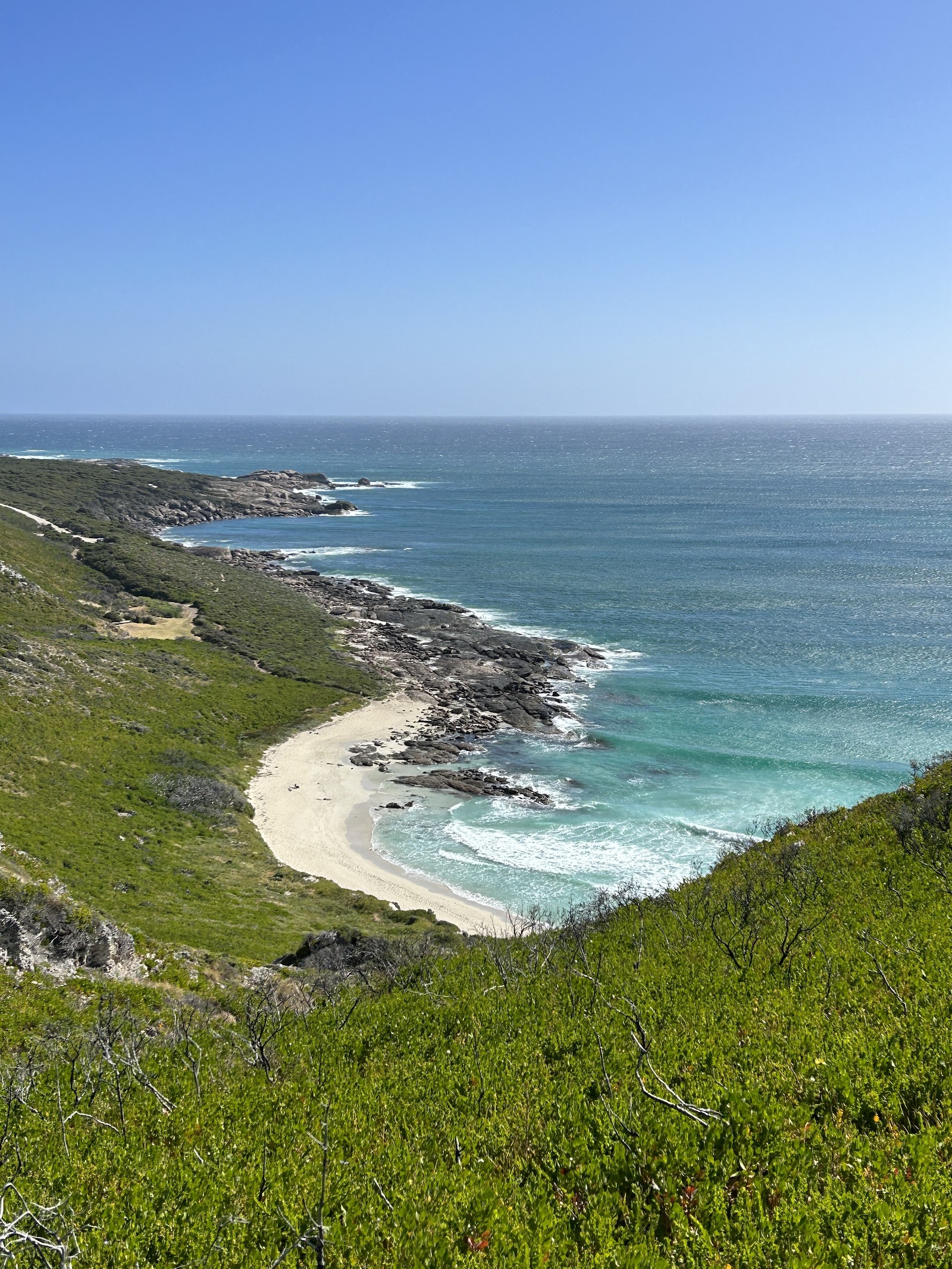
"Coastal cliffs, karri forest, lighthouse headlands"
This guide covers the region's best walks from easiest to most demanding — the accessible lighthouse walks, the Rivermouth and Meelup coastal tracks that suit almost anyone, the standout Cape-to-Cape day sections for confident walkers, and the Boranup Karri Forest walk that feels nothing like the coast. Each entry gives you the distance, difficulty, what you'll actually see, and the honest caveats that distinguish a good walk from a wasted afternoon. One note that applies throughout: this is a limestone and granite coast, exposed to the Southern Ocean and the Indian Ocean simultaneously — the conditions are real, and the walks reward preparation over bravado.
The South West corner of Australia is geographically unusual: it's the only place on the continent where the Indian Ocean and the Southern Ocean meet, and that convergence — at Cape Leeuwin, where a lighthouse has stood since 1895 — gives the walking here a character you don't find anywhere else. The coast between the two capes swings from sheltered swimming beaches to exposed sea cliffs, from karri forest that feels tropical to open limestone heath covered in wildflowers in spring, all within a region you can drive end-to-end in under two hours.
The Cape-to-Cape Track is the skeleton the region's walking hangs on — a 135km coastal route that experienced walkers do in five to seven days, but which non-thru-hikers access in excellent day-walk sections from trailheads up and down the coast. The sections between Gracetown and Cowaramup Bay, or around Cape Naturaliste in the north, are among the most dramatic coastal walking in Western Australia. But the region's best walking isn't only on the cape track: the short Rivermouth walk in town, the Meelup coastal loop above a sheltered bay, and the Boranup Karri Forest track all deliver experiences the coastal cliffs alone can't, and several are accessible to walkers of any fitness or age. The key is matching the walk to your group — get that right and the South West repays it generously.
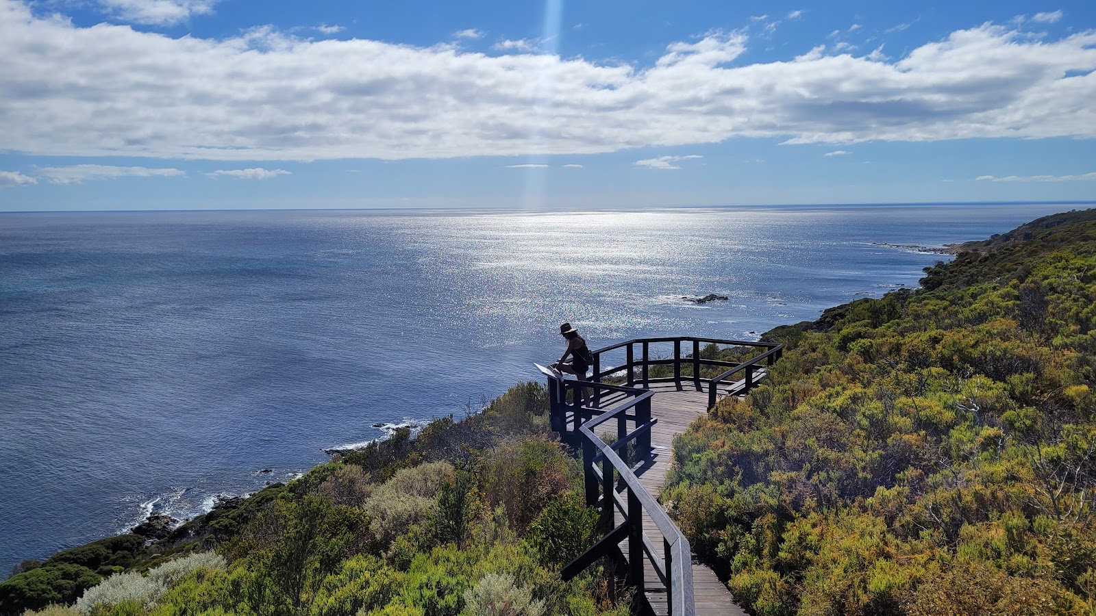
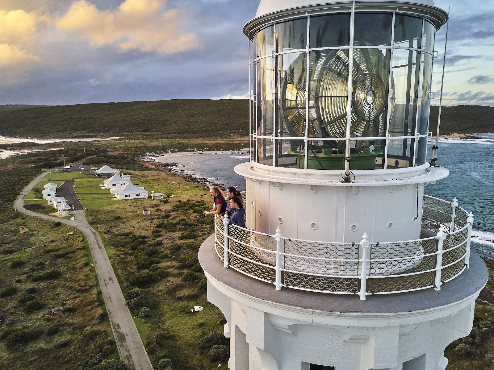
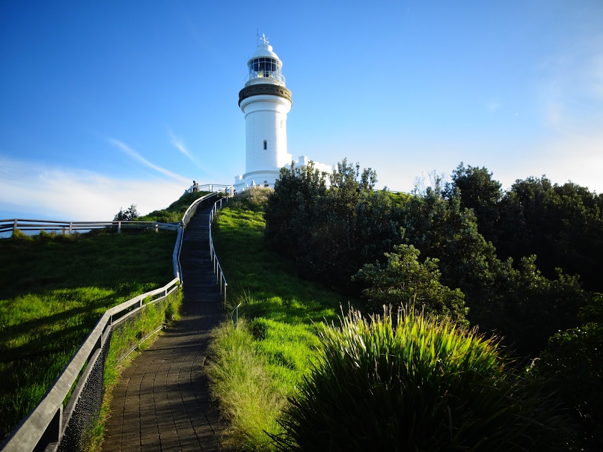
The walk to and around Cape Naturaliste Lighthouse at the northern tip of the Leeuwin-Naturaliste ridge is one of the most rewarding easy-to-moderate coastal walks in the region — not because it's long or strenuous, but because it puts you on a headland between the Indian Ocean and Geographe Bay with 360-degree views and, between August and December, some of the best accessible whale watching in Western Australia. The lighthouse itself dates from 1904 and you can take a guided tour; the walking tracks from the car park range from a short 20-minute stroll to the point to a more substantial 5km loop that takes in multiple lookouts.
The whale watching is the seasonal headline: humpback whales migrate through Geographe Bay on their southward journey between August and December, and the elevated headland lookouts give you elevated, unobstructed sight lines over the bay that shore-based whale watching rarely matches. Outside whale season it's worth the drive for the views alone — the lighthouse working, the ocean on two sides, and the karri-and-peppermint heath that runs down from the ridge. The walk suits almost everyone: the shortest tracks are entirely accessible and the car park is close, making it manageable for older visitors and those with mobility constraints, while the full loop gives confident walkers a proper hour of sea-cliffs and heath. Wind layers are non-negotiable — it's an exposed southern-ocean headland at any time of year.
It's the free whale-watching platform that beats most whale-watching cruises — humpbacks in Geographe Bay from an elevated limestone headland, August to December, no boat required.
“Counted five humpbacks from the lookout in a single morning. An exposed headland, an old lighthouse, two oceans — it's one of those places that makes you feel properly small. Worth every kilometre of the drive.”
— Google review
Humpback whales in Geographe Bay from the headland lookout, August to December.
Wind is relentless on the exposed headland — bring a layer regardless of the forecast. The lighthouse tour has a fee; confirm current hours and tour availability before a special trip. Not suitable for walking with dogs on the National Park tracks — check current rules.
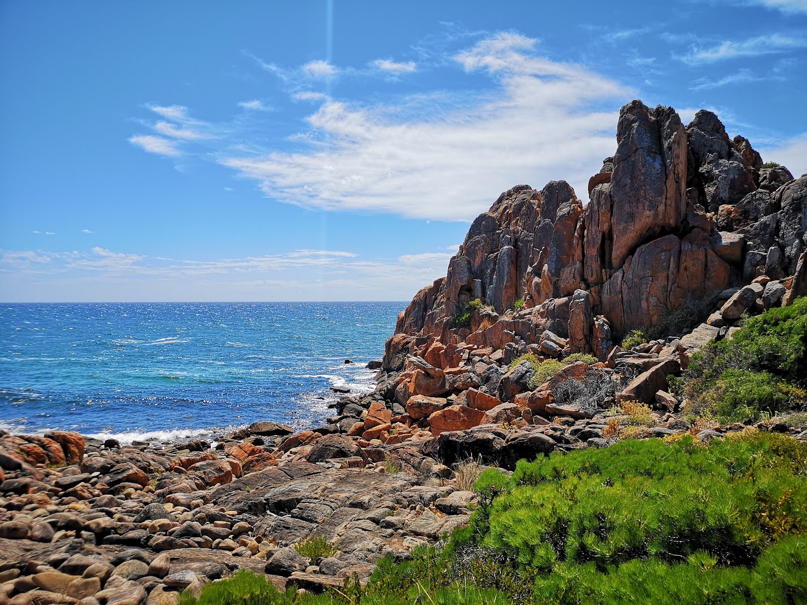
Of all the day-walk sections of the Cape-to-Cape Track, the stretch from Gracetown south to Cowaramup Bay consistently draws the highest praise from experienced walkers — a combination of dramatic sea cliffs, limestone rock platforms, peppermint woodland and a handful of remote coves accessible only on foot that captures the full range of what makes the cape walk exceptional. The ~15km one-way distance means you either arrange a car shuttle or commit to a longer out-and-back; most walkers do the car shuttle, leaving a vehicle at each end.
The sea cliffs above Lefthanders surf break, the exposed limestone headlands above dark-blue Southern Ocean, and the quiet karri-peppermint woodland sections between the coastal edges give the walk a rhythm that doesn't stay in one register for long — which is what makes a long day on foot feel like time well spent. It's best in the cooler months (April to October) when the heath is in better condition, the wildflowers can be extraordinary in spring, and the summer heat and direct sun on the exposed sections are avoided. This is a proper walk: it needs solid fitness, good shoes, sun protection, plenty of water (no reliable sources on the track), and the navigational awareness to know where the trailheads are. Reward it properly and it's the best single day's walking in the South West.
It's the Cape-to-Cape at its most dramatic — sea cliffs, secret coves and coastal heath on a walk that most visitors to the region never attempt, and that rewards everyone who does.
“Arranged a shuttle and walked Gracetown to Cowaramup in a day — cliff edges, coves you can't reach by car, wildflowers through the heath. One of the best days I've had in WA. Budget a full day and go.”
— Traveller review
The sea cliffs above Lefthanders and the remote coves accessible only on foot — southern ocean below, limestone above.
This is a challenging day walk: 15km of exposed coastal terrain needs solid fitness, sun protection and 2–3 litres of water per person (no reliable on-track sources). Arrange car-shuttle logistics before you start. Avoid in the heat of summer — the exposed headlands are brutal above 30°C.
Cape Leeuwin is the southwesternmost point of the Australian continent — the place where the Indian Ocean and the Southern Ocean officially meet — and the lighthouse that has marked it since 1895 is one of the most historically significant in Australia. The walk from the car park to the lighthouse and the adjacent waterwheel ruins is short and easy, under two kilometres with minimal elevation, and guided tours of the lighthouse tower itself are available and worth taking: the view from the top puts you at the literal meeting of two of the world's great ocean systems, with water on three sides and a horizon that stretches to Antarctica.
It's geographically and historically significant enough that first-timers to the South West should make the drive from Margaret River almost without question — the experience of standing at the cape, with the Indian Ocean lapping on your left and the Southern Ocean on your right, is genuinely unlike anywhere else in the country. The walk itself is accessible to almost anyone and the guided lighthouse tour is excellent for children who can manage the stairs. Augusta is about 48km south of Margaret River along the Bussell Highway, making it a half-day commitment from town — pair it with a whale watching lookout at Flinders Bay in season (August to December) and you have one of the better day trips in the South West.
Standing at the meeting point of two oceans with the light working above you is the geography lesson you can actually feel — one of the few places in Australia that lives up to what a map describes.
“You can literally see the two oceans meeting from the lighthouse — different colours, different swells. The lighthouse tour is short but worth every dollar. One of the most memorable spots on the whole WA trip.”
— Google review
Standing at the convergence of the Indian and Southern Oceans from the lighthouse tower, with the old waterwheel ruins below.
The lighthouse tour has an entry fee (check current pricing); the walk itself is free. The site can be busy mid-morning on summer days — arrive early for fewer crowds. Augusta is 48km from Margaret River township, making it a half-day excursion rather than a quick stop.
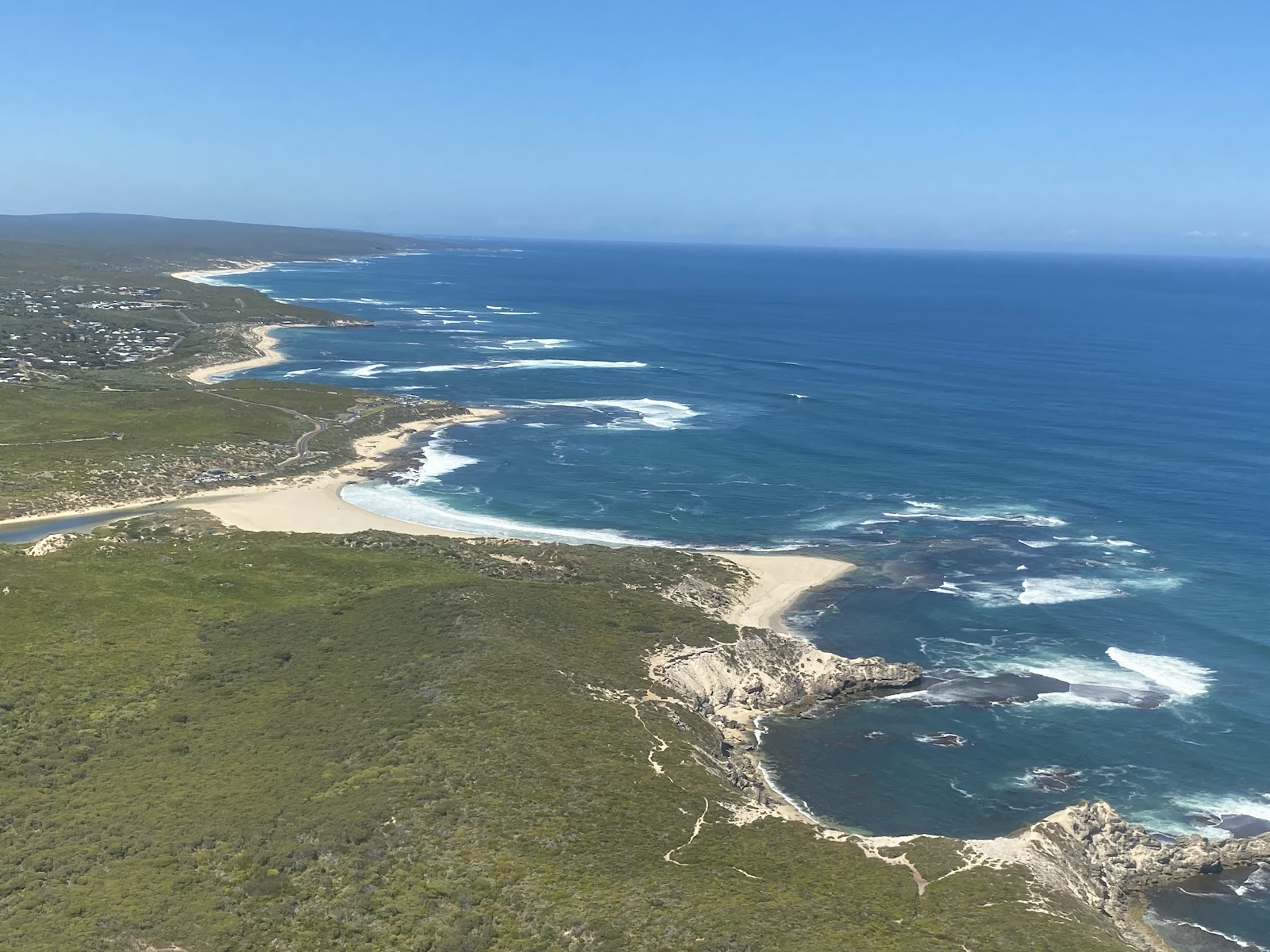
The Meelup coastal walk in Meelup Regional Park north of Dunsborough is the most consistently family-friendly coastal walk in the region — a relatively short loop that links a sheltered, swimmable turquoise bay to a limestone coastal path with Geographe Bay views, wildflower heath and a moderate elevation that keeps things interesting without becoming difficult. The bay itself is one of the most beautiful in the South West: calm, clear, protected and swimmable for most of the year, with a gentle slope and the kind of water colour that belongs in a photograph.
The walk suits the widest possible group: families combining a swim with a coastal stroll, couples after a scenic loop that doesn't take all day, older visitors who find the full Cape-to-Cape sections too demanding, and dog walkers in the regional park (dogs are generally permitted on a lead in Meelup Regional Park, but check current rules for the beach sections). The spring wildflower display along the coastal heath sections adds a layer that makes the walk different in September and October from its summer version. It's paired naturally with Cape Naturaliste Lighthouse — both are within the same northern section of the region, and the two together make a full and satisfying northern day trip from Margaret River.
It's the walk that delivers everything — a sheltered turquoise bay for swimming, coastal cliffs for views, and wildflower heath in spring — without asking more than a couple of hours from any level of walker.
“Swam in the bay and walked the loop with the kids — turquoise water, wildflowers everywhere in October, and finished the day at the lighthouse. One of those days you want to repeat every visit.”
— Traveller review
The turquoise Meelup Bay after the coastal loop — one of the most beautiful swimming spots in the South West.
The beach car park fills on warm summer weekends — arrive early or mid-week. Dogs may be restricted on the beach section; check current Meelup Regional Park rules. The loop is moderate, not easy, so pack water and wear proper shoes.
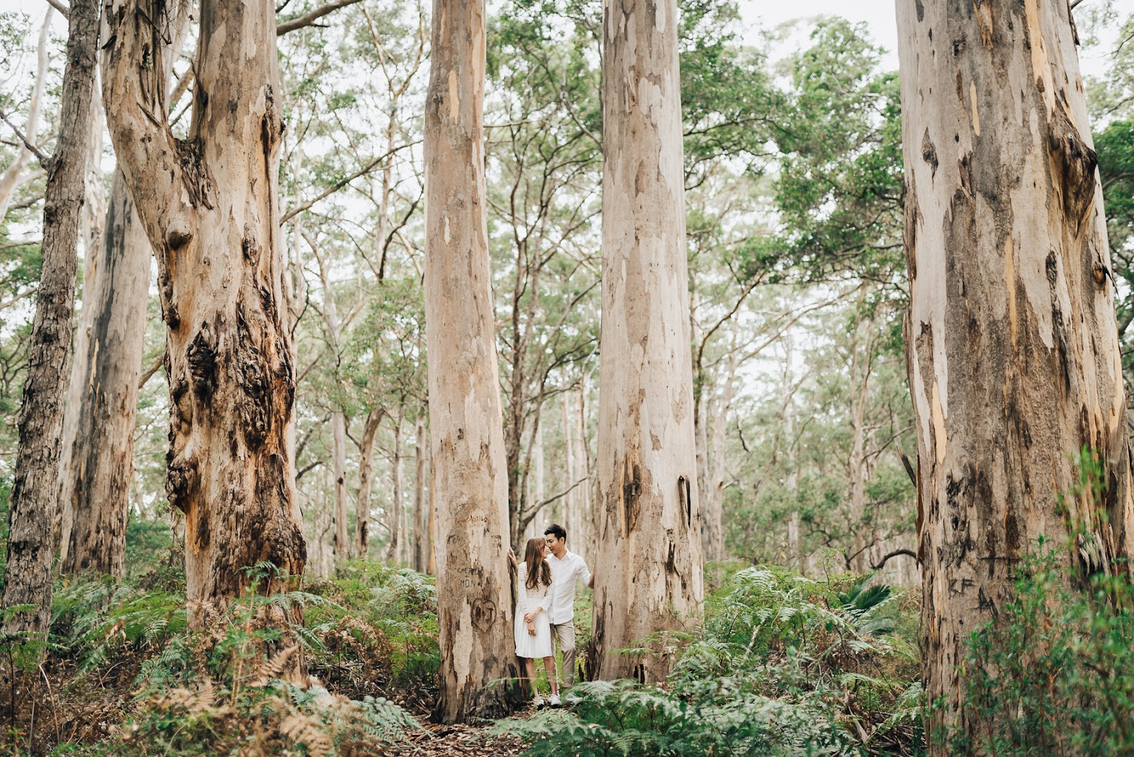
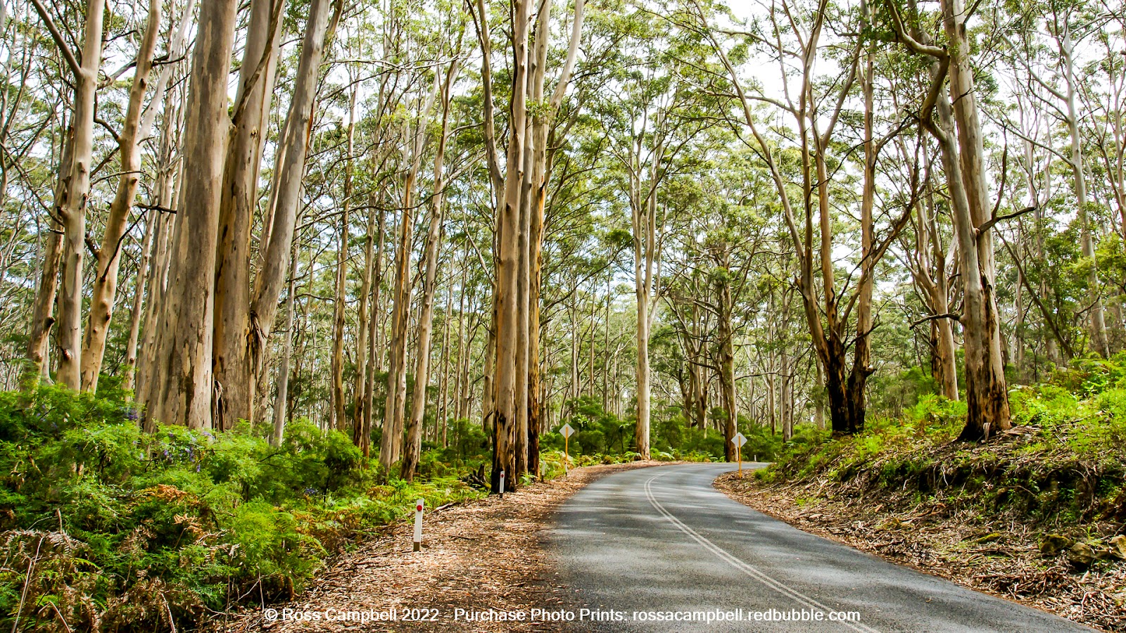
Boranup Karri Forest is the walk in the Margaret River region that has nothing to do with the coast — and it's more striking for it. Karri trees (Eucalyptus diversicolor) are among the tallest flowering plants on earth, and the Boranup section of the Leeuwin-Naturaliste National Park puts you among specimens 60–75 metres high whose white, cream and orange trunks rise out of a surprisingly open, luminous forest floor. Walking among them on the well-maintained tracks has a hushed, cathedral quality that feels completely different from an hour on sea cliffs, and the scale of the trees is one of those things that photographs can't adequately prepare you for.
The trails from the Boranup car park range from an easy 1km loop suitable for almost any fitness level to longer tracks that push into less-visited sections of the forest. It suits anyone who wants contrast — a counterpoint to the coast and the cellar doors that makes the whole trip feel more rounded. It's an excellent wet-weather option when the coastal walks are miserable, a good stop on a Caves Road drive that combines the karri forest with cave tours and the southern cape, and a genuinely special walk for anyone who hasn't experienced old-growth karri before. The walk is mostly flat and shaded; bring insect repellent in spring and summer.
It's the walk that recalibrates your sense of scale — karri trees 60–75 metres high in a forest that's completely silent except for the birds, and nowhere else in the region feels like this.
“Nothing prepares you for how tall the karri trees actually are. We stood at the base of one and couldn't see the top. Quiet, cool, completely different from the coast. Worth a separate trip just for this.”
— Google review
The karri trees — 60–75m tall, luminous trunks, a scale that recalibrates everything.
Boranup is along Caves Road and worth combining with a cave tour or a Caves Road drive south — it's not worth the trip alone if you're time-limited. Insect repellent is advisable in spring and summer. The forest is active in the early morning; midday on hot days is less interesting.
The Rivermouth walk from the township down to where the Margaret River meets the Indian Ocean is the walk you do when you don't want to drive anywhere — an easy, mostly flat trail through riverside vegetation that delivers you to an estuary and a surf beach without a car involved. The Rivermouth itself is a protected, wildlife-rich area: black swans on the estuary, dolphins sometimes in the surf, and Surfers Point — the premier big-wave surf break in the region — a short walk from the river mouth. It's the local's everyday walk and the visitor's orientation walk, and it connects the township to a stretch of coast that the main street can make you forget is only a kilometre away.
The walk suits the full range — families wanting a short easy outing from the township, couples linking a coffee with a beach walk, dog owners on a morning routine, and first-timers getting their bearings. It's at its best early in the morning when the estuary is still and the wildlife is active, but it works at any time. The honest caveat is modest expectations: this is a pleasant, accessible town walk rather than a dramatic cape experience — don't compare it to the sea cliffs north of Gracetown. Its value is proximity, ease and the natural beauty of the estuary and beach at the end.
It's the walk that proves Margaret River's appeal isn't only about driving somewhere — the estuary, the black swans, and a surf beach at the end of an easy stroll from the main street.
“Walked down to the river mouth before breakfast — black swans on the estuary, dolphins in the surf at Surfers Point, and we were back in town for coffee in 45 minutes. Easy, lovely, free.”
— Traveller review
Black swans on the estuary and dolphins at Surfers Point on an early-morning walk from town.
This is a pleasant town walk rather than a dramatic coastal experience — manage expectations and use it as an orientation or morning walk rather than a substitute for the Cape-to-Cape sections. The surf at Surfers Point is for experienced surfers only; swim at patrolled beaches.
| Season | Conditions | Highlights | Crowds |
|---|---|---|---|
| Summer (Dec–Feb) | Hot, dry; coastal wind from afternoon | Long days, full beach season, evening walks to avoid heat | Peak — walk early morning |
| Autumn (Mar–May) | Warm and settled; ideal walking temperatures | Best all-round walking conditions, harvest season | Moderate — best season for the Cape sections |
| Winter (Jun–Aug) | Cooler, wetter; dramatic ocean swell | Whale arrival season (Aug), wildflowers begin, empty trails | Low — best value and solitude |
| Spring (Sep–Nov) | Mild, warming; outstanding wildflowers | Best wildflower season on Cape-to-Cape; whales through to Dec | Moderate — best season for wildflower walks |
What recent visitors say:
“The Voyager Estate is a must visit when you are in the Margaret River area. The gardens are perfectly manicured, the rose garden in gorgeous and the vineyards very pretty. This is a winery on a larger scale. The Dutch inddpired Estate house is absolutely beautiful insand out. There is a restaurant there and a bar area where you can taste wines or oder a smal”— Babs (on Voyager Estate), Google review
“We had a beautiful long lunch at Voyager Estate yesterday. Each dish was delicious and beautifully presented. Maria and Lisanne were excellent hosts. We enjoyed the wine pairing and their philosophy of matching the food to the wine. The gardens are amazing too, especially the rose garden. Not inexpensive, but a great choice for a special day out 💕.”— Michele Campbell (on Voyager Estate), Google review
“Voyage Estate is absolutely wonderful—a true beauty! The food is fantastic, the wine is excellent, and the service is impeccable. Every detail makes it a memorable experience. Highly recommend visiting for a relaxing and indulgent day out!”— Kristie Park (on Voyager Estate), Google review
Conditions: The Margaret River region has genuinely diverse walking terrain — from fully accessible limestone paths and flat forest tracks to exposed sea cliffs and long coastal sections without water or shade. Match the walk to your group, check the weather before you head to the cape, and carry far more water than you think you'll need on the Cape-to-Cape sections.
Safety: The cliffs above the Southern Ocean are not guarded and the rock can be undercut. The sea surges without warning on the limestone platforms at the base of the cliffs. Wear grippy shoes on any coastal track, never go near the cliff edge in windy conditions, and stay on marked paths — the cliff edges can be further back than they appear from inland.
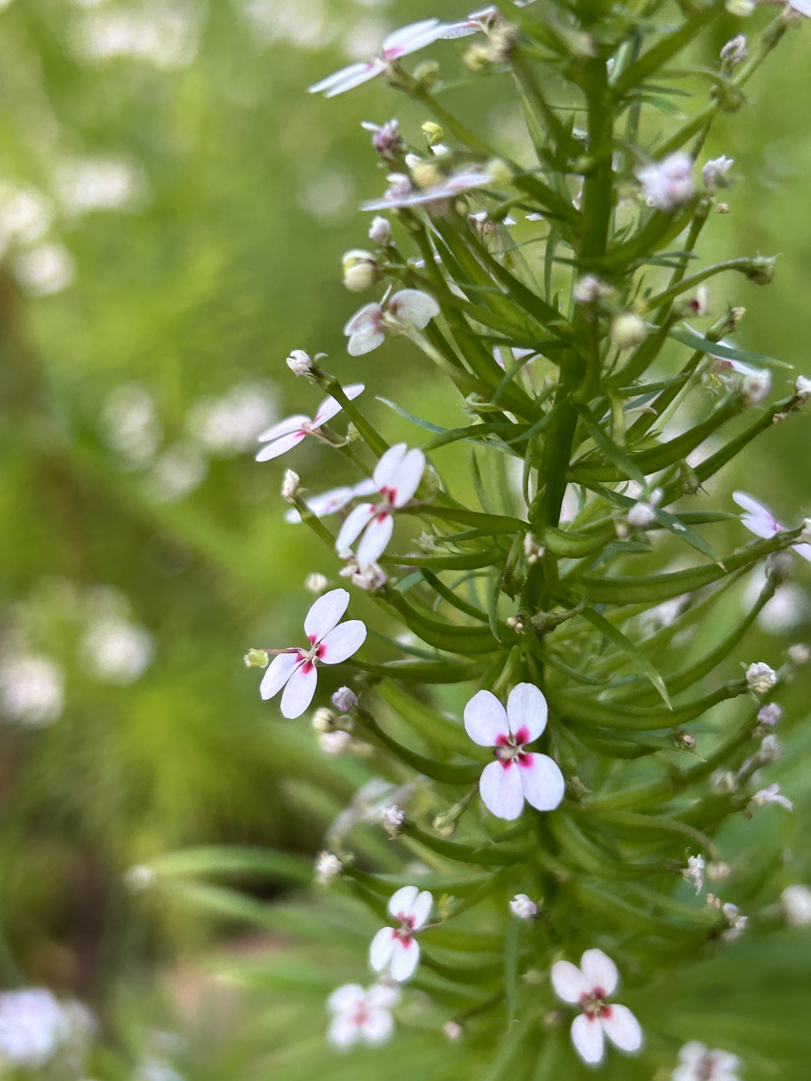
Wildlife: Wildflowers on the cape heath (peak September–October) are genuinely exceptional; download the South West WA wildflower identification app or ask at a visitor centre for what's currently out. The whale-watching season from Cape Naturaliste runs August to December. Dolphins are seen year-round at the Rivermouth and Surfers Point.
Planning: The Cape-to-Cape Track maps and sections are available from Parks and Wildlife WA and from visitor centres in Dunsborough and Margaret River. For multi-day thru-hiking, register your trip and carry a personal locator beacon — mobile coverage along sections of the track is limited.
Start with the walks that match your group before reaching for the most challenging ones. The Rivermouth walk gives you the town's setting in forty minutes; the Meelup loop adds a swim and a proper coastal view; the Cape Naturaliste lighthouse walk delivers a headland panorama and whale watching in season; and Boranup gives you a forest that re-orientates the whole trip.
If your group is capable of a serious day walk, the Gracetown to Cowaramup Bay section of the Cape-to-Cape is the one to build a day around — arrange the car shuttle, start early, carry plenty of water, and walk toward the sea cliffs with the south coast behind you. And if you only have time for one thing in the entire region that isn't a cellar door, drive to Cape Leeuwin and stand at the meeting of the oceans. It's the most distinctively South West experience the region has, and it's a two-kilometre walk from the car park.
Enjoying walks? Here’s where else in Australia it’s worth the trip — ranked by how loved each destination is, with the one thing not to miss at each.
 Kangaroo Valley
Shoalhaven, New South Wales
Fitzroy Falls — East & West Rim — The West Rim lookouts after decent rain, when the falls are thundering.
Explore walks in Kangaroo Valley →
2
Kangaroo Valley
Shoalhaven, New South Wales
Fitzroy Falls — East & West Rim — The West Rim lookouts after decent rain, when the falls are thundering.
Explore walks in Kangaroo Valley →
2
 Broome
Australia's North West, Western Australia
Gantheaume Point Dinosaur Coast Walk — The pindan cliffs glowing red-gold at sunrise, with the dinosaur footprints in the reef flat below.
Explore walks in Broome →
3
Broome
Australia's North West, Western Australia
Gantheaume Point Dinosaur Coast Walk — The pindan cliffs glowing red-gold at sunrise, with the dinosaur footprints in the reef flat below.
Explore walks in Broome →
3
 Byron Bay
Northern Rivers, New South Wales
Cape Byron Walking Track — First light at the easternmost point with humpbacks offshore (May–November).
Explore walks in Byron Bay →
4
Byron Bay
Northern Rivers, New South Wales
Cape Byron Walking Track — First light at the easternmost point with humpbacks offshore (May–November).
Explore walks in Byron Bay →
4
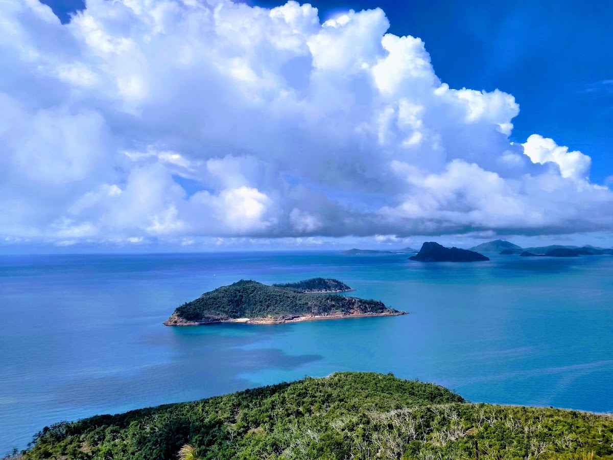 Hamilton Island
The Whitsundays, Queensland
Passage Peak — The 360-degree summit panorama at dawn, with the islands stacked away to the horizon and barely anyone else up there.
Explore walks in Hamilton Island →
5
Hamilton Island
The Whitsundays, Queensland
Passage Peak — The 360-degree summit panorama at dawn, with the islands stacked away to the horizon and barely anyone else up there.
Explore walks in Hamilton Island →
5
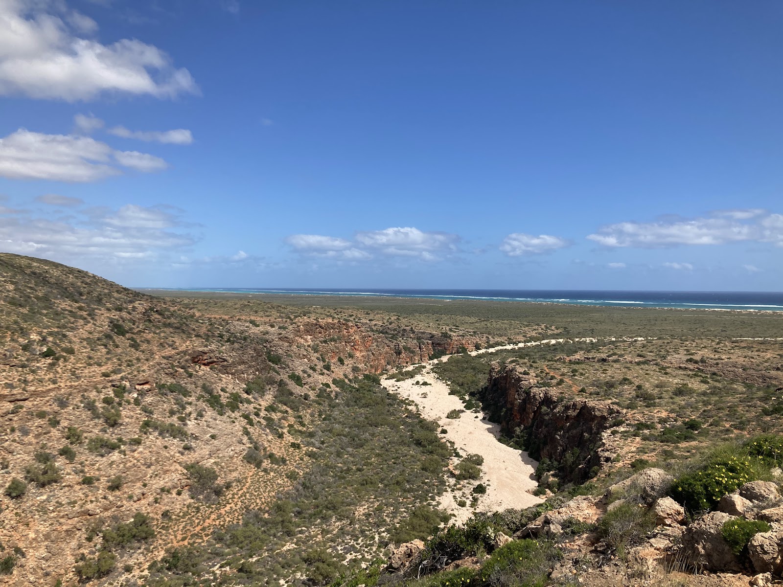 Ningaloo Reef
Australia's Coral Coast, Western Australia
Mandu Mandu Gorge Walk — The gorge descent at first light, with the limestone walls catching the sunrise in orange and ochre.
Explore walks in Ningaloo Reef →
6
Ningaloo Reef
Australia's Coral Coast, Western Australia
Mandu Mandu Gorge Walk — The gorge descent at first light, with the limestone walls catching the sunrise in orange and ochre.
Explore walks in Ningaloo Reef →
6
 Glen Aplin
Granite Belt, Queensland
Mount Stirling Road Vineyard Trail — The northern stretch where the vineyards open on both sides — best light between 7 and 8am.
Explore walks in Glen Aplin →
7
Glen Aplin
Granite Belt, Queensland
Mount Stirling Road Vineyard Trail — The northern stretch where the vineyards open on both sides — best light between 7 and 8am.
Explore walks in Glen Aplin →
7
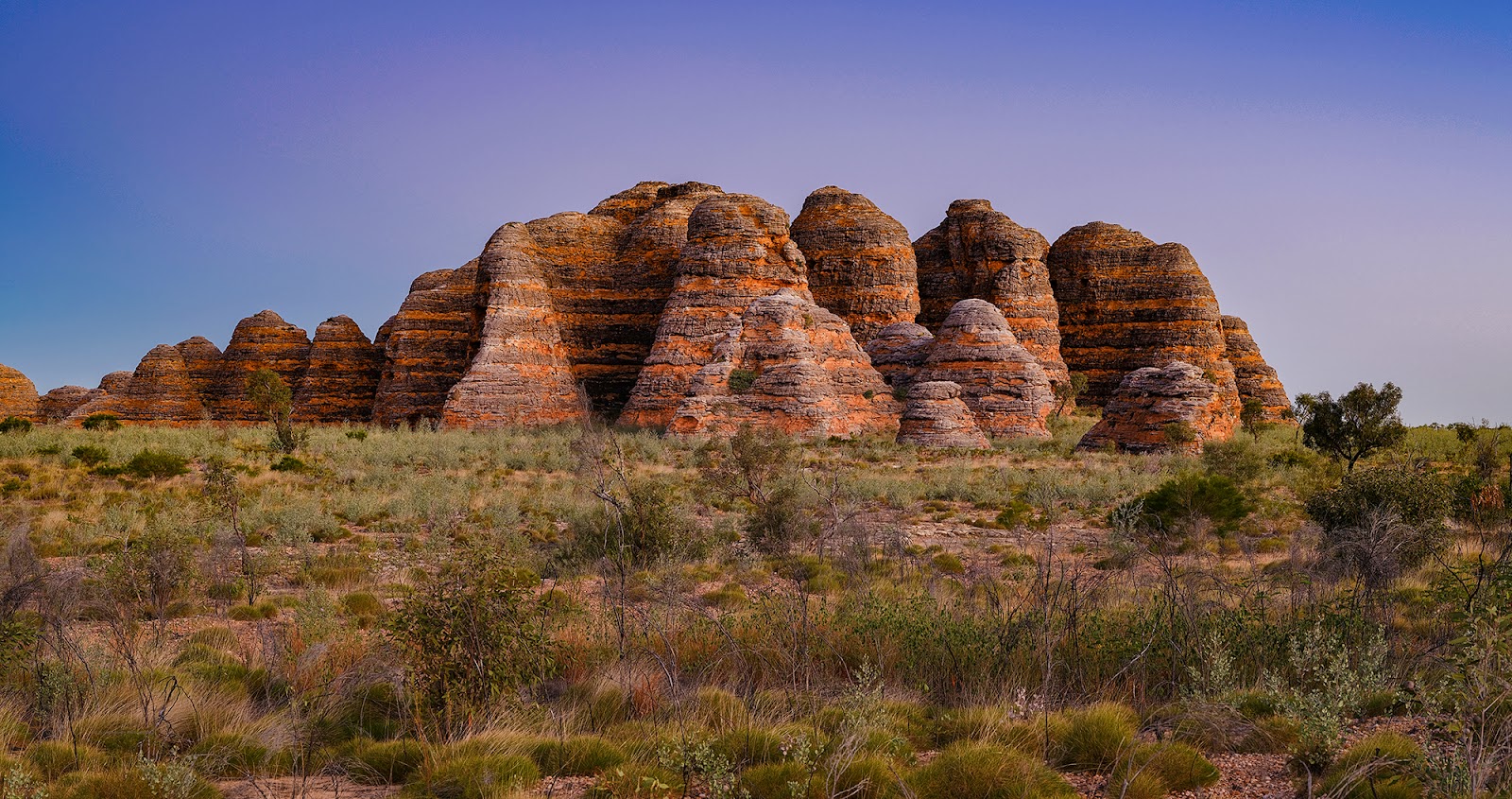
 The Kimberley
Australia's North West, Western Australia
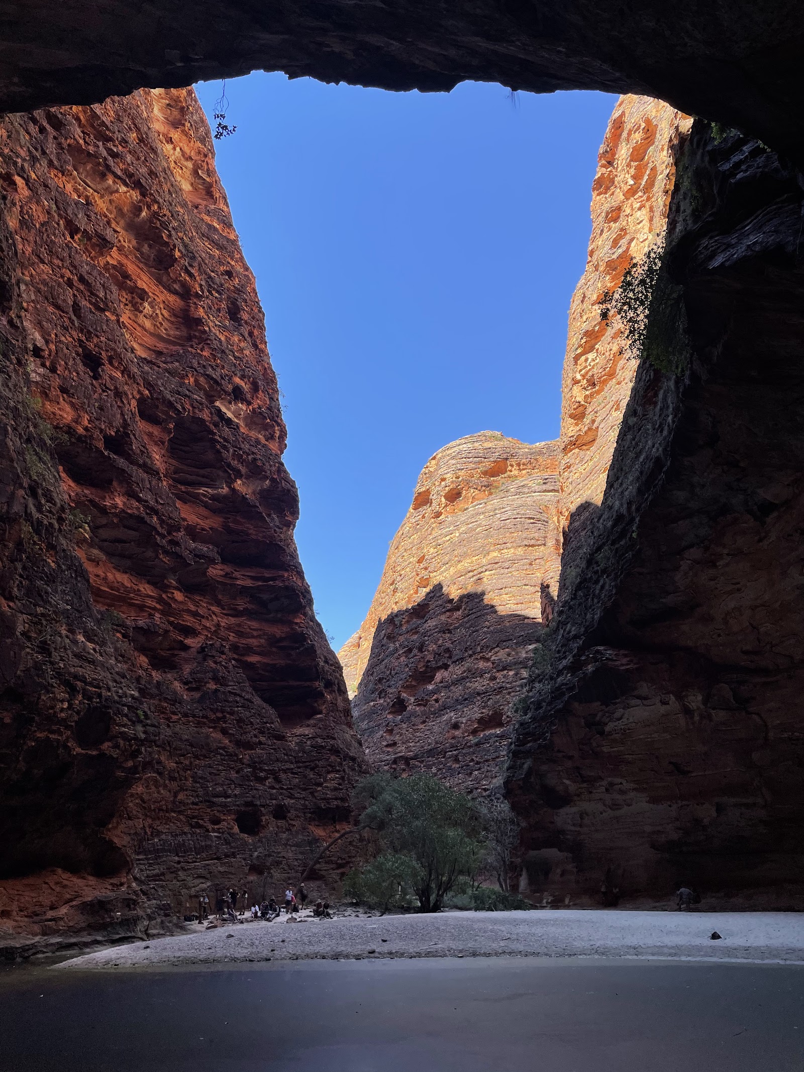
Cathedral Gorge, Purnululu National Park — The natural amphitheatre at the end of the gorge — arrive at sunrise for the walls glowing orange in the first light.
Explore walks in The Kimberley →
Margaret River you’re here
Australia's South West, Western Australia
Cape Naturaliste Lighthouse Walk & Whale Lookout — Humpback whales in Geographe Bay from the headland lookout, August to December.
You’re reading this guide
The Kimberley
Australia's North West, Western Australia
Cathedral Gorge, Purnululu National Park — The natural amphitheatre at the end of the gorge — arrive at sunrise for the walls glowing orange in the first light.
Explore walks in The Kimberley →
Margaret River you’re here
Australia's South West, Western Australia
Cape Naturaliste Lighthouse Walk & Whale Lookout — Humpback whales in Geographe Bay from the headland lookout, August to December.
You’re reading this guide
 Narooma
South Coast, New South Wales
Mill Bay Boardwalk — Stingrays gliding below the planks in the clear shallows — best in the still early morning.
Explore walks in Narooma →
10
Narooma
South Coast, New South Wales
Mill Bay Boardwalk — Stingrays gliding below the planks in the clear shallows — best in the still early morning.
Explore walks in Narooma →
10
 Dubbo
Central West, New South Wales
Tracker Riley Cycleway — The riverbank at dawn, with mist on the water and the birdlife at its busiest.
Explore walks in Dubbo →
Dubbo
Central West, New South Wales
Tracker Riley Cycleway — The riverbank at dawn, with mist on the water and the birdlife at its busiest.
Explore walks in Dubbo →
Margarets Beach Resort — Margaret River
Book Direct & Save →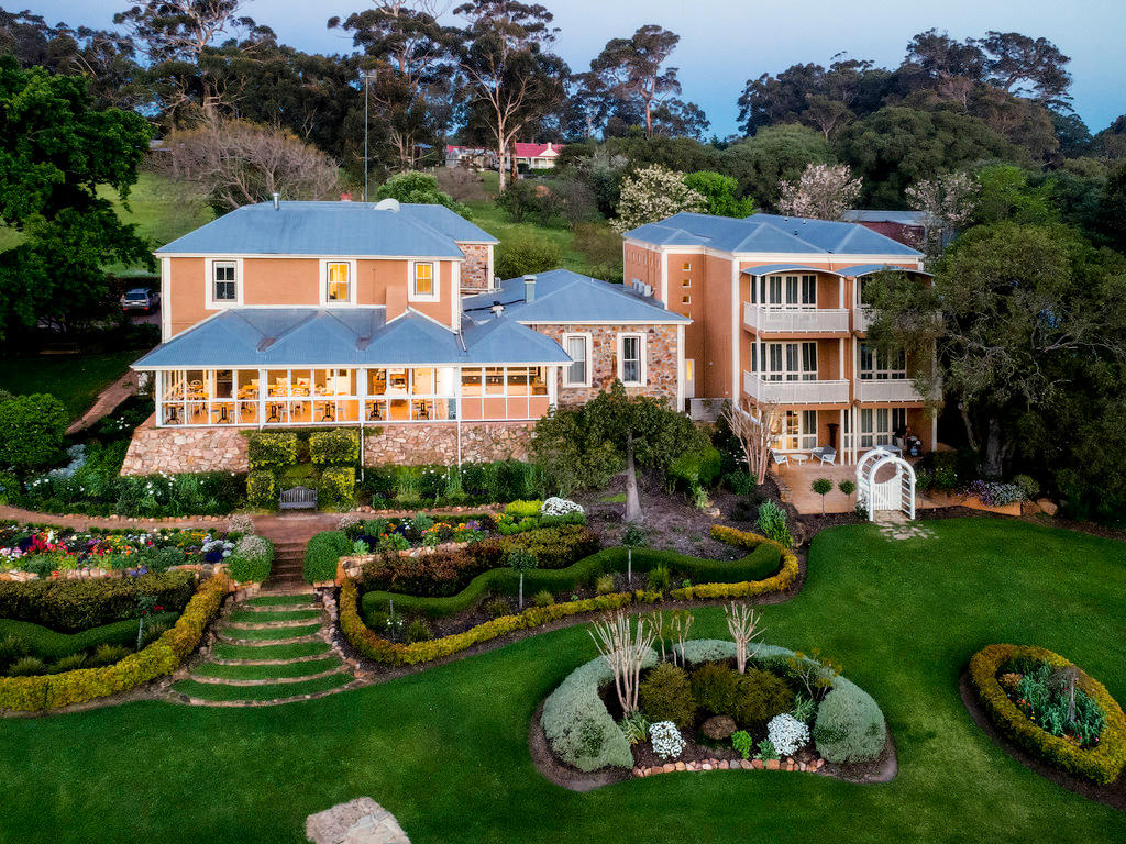
Margaret River Guest House — Margaret River
Book Direct & Save →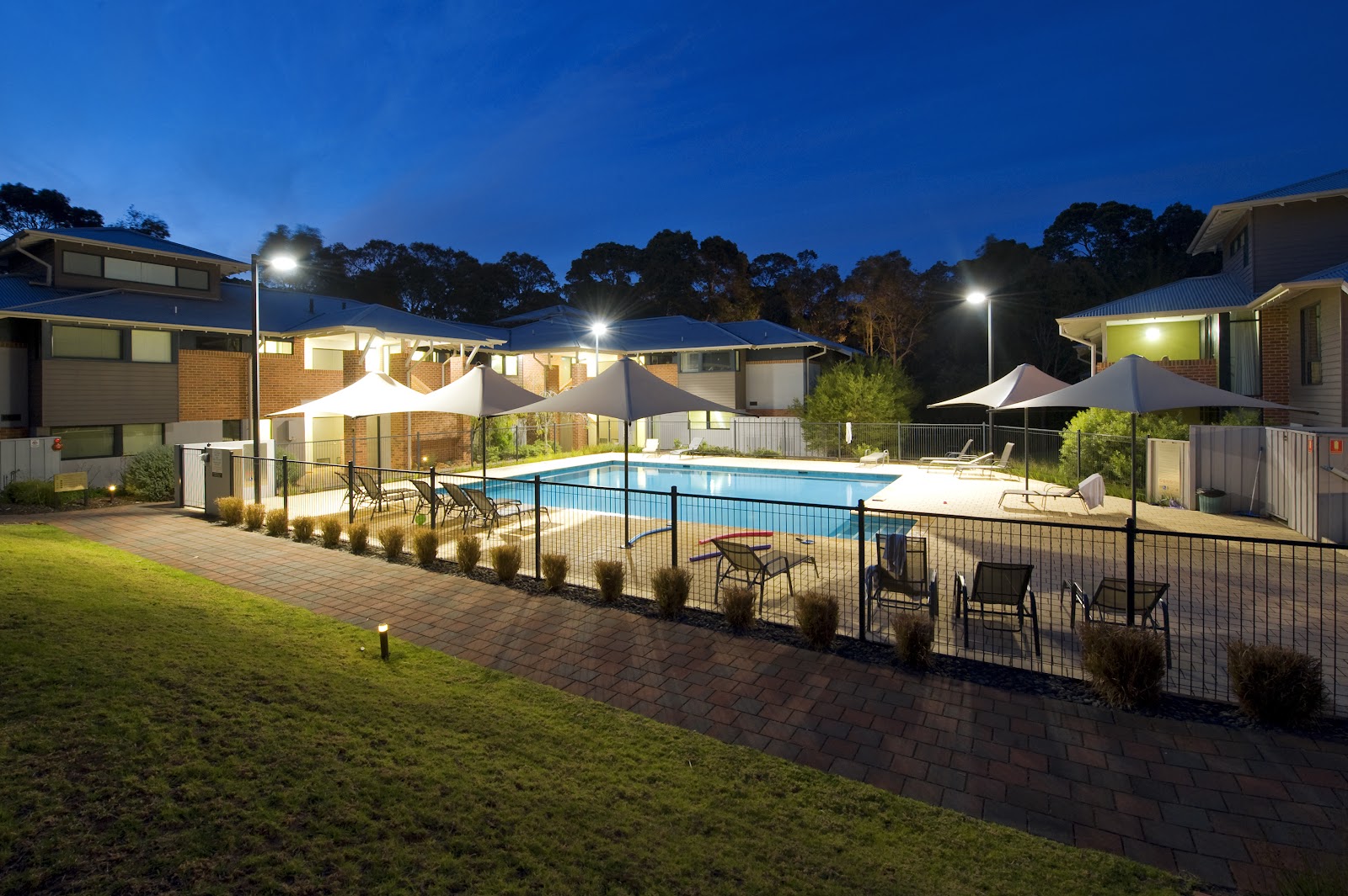
RAC Margaret River Nature Park — Margaret River
Book Direct & Save →Skip OTA fees. Connect directly with Margaret River owners for the best rates and a truly personal experience.
We match any online rate. No service fees — 100% of your payment supports local owners.
Direct guests receive complimentary hampers, early check-in, and priority access to experiences.
Speak directly with the people who manage the properties. No call centres, just local expertise.
Part of Western Australia · Australia's South West
 Glen Aplin
Granite Belt, Queensland
Queensland's most underrated wine valley
Explore the guide →
Glen Aplin
Granite Belt, Queensland
Queensland's most underrated wine valley
Explore the guide →
 Hamilton Island
The Whitsundays, Queensland
Whitsundays island resort — Whitehaven Beach, reef trips and golf-buggy life
Explore the guide →
Hamilton Island
The Whitsundays, Queensland
Whitsundays island resort — Whitehaven Beach, reef trips and golf-buggy life
Explore the guide →
 Narooma
South Coast, New South Wales
Crystal-clear inlet, surf beaches, oysters and Montague Island
Explore the guide →
Narooma
South Coast, New South Wales
Crystal-clear inlet, surf beaches, oysters and Montague Island
Explore the guide →
 Kangaroo Valley
Shoalhaven, New South Wales
Hampden Bridge, kayaking and wombats in a green valley
Explore the guide →
Kangaroo Valley
Shoalhaven, New South Wales
Hampden Bridge, kayaking and wombats in a green valley
Explore the guide →
 Dubbo
Central West, New South Wales
Open-range zoo and Outback gateway on the Macquarie River
Explore the guide →
Dubbo
Central West, New South Wales
Open-range zoo and Outback gateway on the Macquarie River
Explore the guide →
 Byron Bay
Northern Rivers, New South Wales
Australia's iconic beach town and most easterly point
Explore the guide →
Byron Bay
Northern Rivers, New South Wales
Australia's iconic beach town and most easterly point
Explore the guide →
 Ningaloo Reef
Australia's Coral Coast, Western Australia
Swim with whale sharks and snorkel a World-Heritage reef straight off the beach
Explore the guide →
Ningaloo Reef
Australia's Coral Coast, Western Australia
Swim with whale sharks and snorkel a World-Heritage reef straight off the beach
Explore the guide →
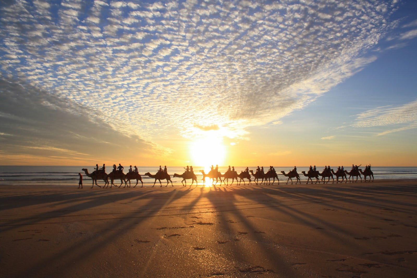 Broome
Australia's North West, Western Australia
Cable Beach sunsets, pearling history and camels on 22km of sand
Explore the guide →
Broome
Australia's North West, Western Australia
Cable Beach sunsets, pearling history and camels on 22km of sand
Explore the guide →
 The Kimberley
Australia's North West, Western Australia
Gibb River Road, the Bungle Bungles, gorges and waterfalls in Australia's last frontier
Explore the guide →
The Kimberley
Australia's North West, Western Australia
Gibb River Road, the Bungle Bungles, gorges and waterfalls in Australia's last frontier
Explore the guide →